After having to twice cancel a weekend tramp into the Avoca Hut (still very much on the to-do list), due to firstly a chickenpox outbreak here in Oxford, then secondly the expected arrival of Tropical Cyclone Lusi, we decided to change approach slightly - with a mid-week day trip a good alternative. We had our bosses on relatively short notice that a day off was likely - as soon as a window of fine weather presented itself we would be off. This approach seemed to work well, and may well be repeated in the future!
Our goal was to climb Castle Hill Peak, which, at 1998m, is the highest summit of the Torlesse Range. Porters Pass provided a good launching pad for the climb, enabling us to start at 942m, but by the time all the ups and downs of the travel along the ridge were factored in, we still had around 1200m of vertical height to be gained before reaching the summit.
There was no easing into this tramp. Most trips give you at least some flat ground to warm the muscles up before starting to climb but from the layby at the top of the pass it was straight into the climb. The route took us directly up the ridge to Foggy Peak, our first objective for the day. It's a climb of 800m altitude to reach Foggy Peak, which started moderately steeply but as we made our way up the broad ridge the gradient steepened ever more, with little respite save for one flat area at around 1500m. This is not technical climbing by any stretch - all that is required is the willingness to keep moving upwards, working your way up the ridge on a well formed foot trail. If you're eager to reach the summit of Foggy Peak then the numerous false summits may frustrate you, but on gaining the summit proper you will be rewarded with superb views.
Just below the summit of Foggy Peak we gained our first view of our goal - Castle Hill Peak, which was a somewhat daunting sight (at least to me anyway!), standing still high above us along the ridge, and seemingly still a long way off. From here we continued just a short distance to be standing atop Foggy Peak after a little over 2 hours, having had many a stop for photos and chatting on our way up. This is one of the joys of a day trip like this - being able to take the time to stop, chat, and look around, reveling in the majesty of God's Creation.
The view from Foggy Peak was stunning, taking in a huge tract of the Canterbury high country, with Aoraki/Mt Cook visible to the southwest. Even just to come this far would be a worthwhile trip, but we had loftier intentions so after a short stay we descended off the summit and began our trek along the ridge to Castle Hill Peak, which lay around 3km away.
From Foggy Peak we descended around 80m to a broad saddle, the downside to this being we had to regain that lost altitude. The ridge travel was straightforward, trending upwards (which became our phrase of the day), and in a little over an hour we were almost at the foot of the summit ridge of Castle Hill Peak. This final ridge rose very steeply in front of us, presenting one last challenge before we claimed the summit. By now we were all feeling slightly empty so found a nice spot beneath a rock outcrop to stop for lunch, refueling for the final push to the summit.
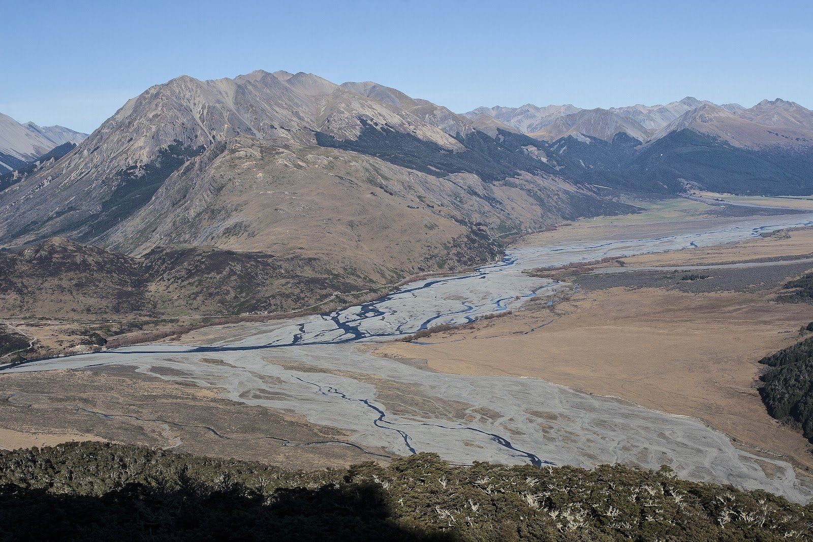
The view across the basin below was magnificent. Spread in front of us was the entire Craigieburn Range, with its' numerous ski access roads seen snaking their way up to the top basins where thousands spend their winters on the slopes.
After half an hour we were ready to go again. The ridge narrowed markedly, with steep drop offs on both sides but in the absence of snow presented no danger. I expect in winter it would be icy and probably corniced, so caution would be required in those conditions.
Despite the steep gradient we were buoyed by lunch, and by knowing it was now only around 180m height gain to the summit which, given the steepness of the ridge, would be gained quickly - one advantage of steep terrain - and after 40 minutes of steady progress we set foot on the summit. Unable to contain himself any longer, Ian had shot ahead, perhaps gripped by summit fever, so when Brent and I got our first look at the summit trig a short distance away, he was almost there. We were re-united a minute or so later, and engaged in the usual congratulations before dropping gear to enjoy our time on top of the range.
It is hard to put into words all we could see from our vantage point. Being the highest peak on the Torlesse Range meant we had it all before us. We took a moment to scout out the route to The Gap, a well-visited feature of the range, and definitely one we'd like to visit. The Puketeraki Range lay beyond, stretching off northwards into the haze. Moving anti-clockwise, the eye roams over all of eastern Arthur's Pass National Park, then round to take in the Craigieburns, with Mt Rolleston rising behind, and the Broken River/Castle Hill Village basin in front at our feet. From there the peaks of the Rakaia headwaters take centre stage, with the Arrowsmith Range dominating, and, further away, Aoraki/Mt Cook, which was even more striking from here, with Sefton & Tasman nestled either side. With a good collection of maps (I didn't carry all of mine) and compass you could spend an hour or more picking out peaks, passes, and valleys.
After half an hour we started our descent, now trending downwards as the saying went. It was amazing how quickly we progressed, the steep terrain offering fast travel. We were back at the saddle below Foggy Peak in 1 hour, and after the last climb of the day, a slow slog back up onto Foggy, we were relieved to be able to say that it was all downhill now.
From here we decided to abandon the foot trail, it compressed nature made it a little awkward underfoot when heading downhill. Instead we just went straight down, finding the softer, more natural rock slopes easier. One final stop about halfway down just to savour the final moments of a great day out, then we were back at the car, in exactly half the time it took going up.
A memorable day, suitable for anyone with moderate fitness looking for a challenging but rewarding day trip.
 |
| The view starts to open up as we gain height heading up Foggy Peak |
 |
| Making our way up the ever steepening slopes of Foggy Peak |
 |
| Time for morning tea, 400m above the carpark but only halfway up Foggy Peak |
 |
| Looking down the Kowai River and across the Canterbury Plains |
 |
| Not your typical selfie! |
 |
| An indication of the steepness of the upper slopes of Foggy Peak, with Mt Enys in the background |
 |
| Lake Lyndon, viewed from around 1500m on the way up Foggy Peak |
 |
| A rare, in fact the only, flat spot on Foggy Peak Ridge - at around 1500m |
 |
| Our first view of our goal, Castle Hill Peak - still looks a long way to go |
 |
| Lake Lyndon, with the Hutt and Black Ranges and Rakaia River beyond, from the summit of Foggy Peak |
 |
| Porters Ski Area (right), Arrowsmith Range (centre background), Aoraki/Mt Cook (left background) |
 |
| Craigieburn Range, from Foggy Peak |
 |
| View east, from Foggy Peak - Port Hills just visible in the centre |
 |
| Peaks of the Torlesse Range - Castle Hill Peak at left, Mt Torlesse to the right |
 |
| The route ahead of us to Castle Hill Peak |
 |
| Arrowsmith Range |
 |
| Aoraki/Mt Cook, seen from Foggy Peak |
 |
| Looking across to the mountains of the upper Rakaia Valley, Arrowsmiths dominating |
 |
| Canterbury Plains and the Port Hills, Waimakariri River on the left |
 |
| Ben More and the Big Ben Range, with Mt Hutt right background |
 |
| Descending to the deep saddle past Foggy Peak |
 |
| An arrow marks the saddle, could be useful if returning in poor visibility |
 |
| Striking out along the ridge to Castle Hill Peak |
 |
| Good look at the broken, rugged terrain that typifies the Torlesse Range |
 |
| Good spot for lunch, as we prepare to take on the summit ridge ahead |
 |
| View across the Castle Hill basin. Porter River in front, Craigieburn Range behind |
 |
| Moon faintly visible above the summit of Castle Hill Peak |
 |
| Not a good time to slip, plummeting scree slopes fall steeply off the summit ridge |
 |
| Making our way up the summit ridge of Castle Hill Peak |
 |
| Looking down in the basin at the head of Ghost Creek |
 |
| Ian makes a dash for the summit... |
 |
| And arrives |
 |
| On the summit of Castle Hill Peak (1998m) |
 |
| Aoraki/Mt Cook, flanked by Sefton and Tasman, from the summit of Castle Hill Peak |
 |
| Porters Ski Area, with the Arrowsmith Range a stunning backdrop |
 |
| Mt Hutt |
 |
| Mt Rolleston |
 |
| Waimakariri River, with Christchurch city under murky cloud |
 |
| L to R: Red Peak, Back Peak, Junction Peak, Otarama Peak (rear), and Mt Torlesse |
 |
| Northern end of the Craigieburns, with the mountains of Arthur's Pass beyond, Mt Rolleston to the left rear |
 |
| Broken River glistening in the sun, Mt Rolleston at rear |
 |
| Descending off Castle Hill Peak |
 |
| Surveying the route back across the tops |
 |
| Easy travel along the ridge back towards Foggy Peak. Note the windswept profile |
 |
| Great day to be in the mountains |
 |
| Near the saddle below Foggy Peak, Ian well in front practising his scree running |
 |
| Back at the saddle, with our final climb ahead of us |
 |
| Who had time to build this anyway??? |
 |
| Peaks of the Torlesse Range, good reason to pause on the climb back onto Foggy Peak! |
 |
| Checking the bat-phone on Foggy Peak |
 |
| Lake Lyndon |
 |
| Lake Lyndon, backed by the Hutt and Black Ranges |
 |
| Final look at Castle Hill Peak and our route along the ridge |
 |
| On the upper slopes of Foggy Peak - one has to be in awe of God's Creation |
 |
| Descending Foggy Peak the fast way - straight down |
 |
| Crown Copyright - Land Information NZ |
 |
| Panorama looking west from the summit of Castle Hill Peak |
 |
Panorama of the Torlesse Range
Access: Take SH73 towards Arthur's Pass, and park at the top of Porters Pass.
Time: Carpark to Castle Hill Peak 5hrs, return 2hrs 30mins
Map: BW21 Springfield
Hut: None
|