With a decent spell of fine weather forecast, after a few unsettled weekends in a row, an overnight tramp in to Crow Hut up in Arthur's Pass National Park was the plan. Heavy snow early in the week however had us having a bit of a re-think, so a backup plan was formulated to head in to Lake Christabel Hut.
I gave the DOC offices in both Arthur's Pass and Reefton a call midweek to check on conditions, with Arthur's Pass still gripped with snow and the avalanche risk in the upper Crow significant enough to make me change plan and head to Lake Christabel, especially after a great conditions report from the DOC officer up that way.
Late in the week though, I was having doubts. It's quite a long walk in to Lake Christabel Hut and with short winter days it would require a very early start from Oxford, making for an unpleasantly early drop off of the kids to my mum. Plan C was proposed - a tramp to Double Hut down in Hakatere Conservation Park, with the option of coming out via Manuka Hut, should conditions allow us to get our 2WD vehicle in to Castleridge Station, the exit point of the through trip. A quick email to Mt Arrowsmith Station suggested good conditions, with around 6 inches of snow on the ground but otherwise all looked great, so off we went.
Five of us made the scenic drive up to Lake Heron, having first dropped our car off at Castleridge Station. Although plenty of snow, it was firm so driving the side road was manageable and, after Ian had driven in some tracks for me to park off road, we had no issue with the conditions. The trip was on!
Had I not been in contact with the station prior to heading out, we would have no idea of what awaited us once in the Heron basin. There was no sign of any low level snow at all heading inland from Mt Somers Village, and it wasn't until we approached Maori Lakes that we got our first look at the winter spectacle we were to be treated to on this tramp. Ahead lay a wonderland of snow, carpeting the basin as far as the eye could see, but the main road had been well driven so getting up to Lake Heron proved straightforward.
Once at the lake we drove in on the rough road that rounds its' southern shores, reaching the carpark a short distance around, but at least that was distance we didn't have to walk. Slightly concerning was the number of vehicles parked there but with the multitude of short walks in the area we were hopeful that most of the vehicles belonged to day trippers as Double Hut only contains 6 bunks.
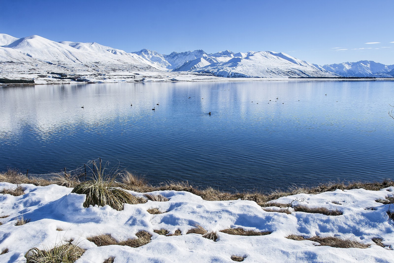
The track in to Double Hut was an easy one, our progress only slowed initially by Toby's constant bombardment with snowballs, and my constant stopping to take more photos! The view across Lake Heron to the Arrowsmith Range was certainly one to savour, and it also had me fondly recalling last years trip to Cameron Hut (see
here).
As we rounded the lake we set out across a river terrace sandwiched between Mellish and Swin Streams. Although only climbing gradually, our pace slowed along here as Toby started to feel some blisters developing but, after a stop to patch things up and encourage him onwards, we were on the move again.
Ahead we could see another party apparently also heading for Double Hut. They had been moving slower than us, a group of 3...or so it seemed at first glance, for the next time we spied them there appeared to be 5 of them. With only 6 bunks at the hut this was a little alarming, and became even more so when the 5 became 9, then 13, then 17! Were they multiplying on the track? This also, in a way, came as some relief - surely a party of 17 wouldn't head to a 6 bunk hut to stay overnight!
We trekked on, the hut slowly getting closer, and we received the good news from a tramper heading out that the large group were just out for the day, news that made it much more relaxed as we stopped for lunch at a fenceline not far from the Swin River North Branch.
With full bellies, and the bulk of the distance behind us, we were spurred on to reach the hut. The Swin River North Branch proved an easy ford, and we slogged through deepening snow up the final slopes to reach Double Hut just after 3pm, exactly 4 hours after setting out - not bad time considering the blisters and the snow.
We arrived to find 3 in residence, 2 who were ski touring and using the hut as a base, and a mountaineer who had passed us late in the tramp because he knew a short cut! This meant 3 of us had bunks, the obvious choices being the two ladies and Toby, with Ian and I happy enough to 'rough it' on the floor.
By the evening 2 more parties had arrived, making for a merry bunch of 13, the last 3 deciding to sleep out in the dog-kennel-like woodshed. They were so cold that they abandoned their predawn start up Mt Taylor!
Double Hut is a classic musterers hut, built sometime around 1902-1906. A small extension was added around 1930. It contains 6 bunks, an open fireplace that, like so many in huts like this, allows most of the heat up the chimney and smokes quite a bit, a solid wooden table (solid enough for Ian to sleep on it), and plenty of history and character. In keeping with mustering tradition, the names of those in the mustering crews are etched into boards all over the hut.
The hut services many outdoor types, evidenced by the variety in users on this night. Of the 13 there, 4 were mountaineers heading up Mt Taylor, 2 ski touring, 2 just in for a quick in and out tramp, and us 5 who were tramping further afield.
We had a great afternoon in the glorious afternoon sun, for which the hut is perfectly sited. Snowball fights, exploring, makeshift tabogganing down slopes - all great fun! When the sun went though, we were plunged into deep cold and the hut was a welcome refuge.
The next morning I was out and about, climbing the slopes above the hut and was treated to a spectacular mountain sunrise. I'm not sure the photos do it justice, sometimes you just have to be there to experience it.
We made a leisurely getaway, leaving around 9.45am, partly due to it being cold and partly because there was no real rush. The distance down to Manuka Hut, our planned stop for a cuppa and an early lunch, is not great so we felt no urge to race out the door as others had done.
We struck out across the snow covered terrain, cutting the corner to intercept the track to Manuka Hut a bit further along. While meaning we would travel a shorter distance, it also meant we were plodding through deeper snow. It was slowish going at times, but we found if I made steps for Julia and Toby then their progress was made significantly easier, so this was our fare for quite some time.
The first feature we came to was Seagull Lake. It was frozen over and mostly snow covered so there wasn't too much to see, so on we went.
The next section was quite taxing, plodding up and over the wide fan of Finger Stream. The snow through here was deeper and soft but not too difficult, the hardest thing I found with my step-plugging was keeping my stride short enough for the others following to manage comfortably. Occasionally I'd hear a little voice "Papa, can you make your steps shorter?".
Manuka Lake was almost identical to Seagull - frozen and covered in snow. Travel was easier along here though due to its' lower elevation and a thinner snow pack, and shortly after passing the lake we reached the signpost indicating Manuka Hut was only minutes away. To reach the hut we had to enter the side valley, which was still in shade. It didn't make the hut seem a very attractive prospect for lunch, but on rounding the bend in the valley we saw the hut perched on a terrace in brilliant sunshine. Lunch now couldn't come fast enough!
Manuka Hut, like Double, has 6 bunks and an open fireplace but rather curiously doesn't have a dedicated cooking bench. If you use a standard gas cooker you could likely cook on the wooden shelf on the hut wall, but given the heat my Whisperlite generates I didn't want to risk cooking there, opting instead to cook on the top of a drum sitting inside the hut.
Lunch was pleasant in the sunny hut but time was marching on so we didn't linger, setting off down the Stour River which looked like it would provide easy travel on snow that had really thinned out.
We quickly, much quicker than I'd expected, reached the point where trampers leave the Stour and climb over a low ridge to Lake Emily. The climb looked easy and was even easier than it looked, angling across the face to gain the ridge at its' low point. Toby led the charge on the climb, seemingly invigorated by the fact he had been given the responsibility of leading the climb.
The descent was just as easy, with a nice trail having been blazed through the snow by a party of 4 we'd passed heading in to Manuka, and before long we were striding out on flat ground heading for the carpark at Lake Emily. 4WD vehicles can drive in to Lake Emily, thus cutting out the section between Castleridge Station and the lake.
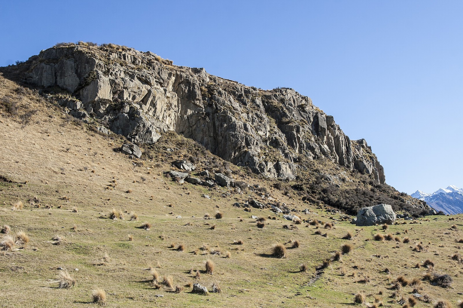
Lake Emily was rather attractive, sitting below the track but with wonderful views back to the Mt Somers Range and all the way up to the Arrowsmith and Big Hill Ranges.
A cool wind had picked up as we passed the lake, cutting our planned rest stop short, so we carried on along the vehicle track that cuts around the base of the hill. It was a wonderfully easy end to the tramp, the vehicle track being well graded and never really climbing much at all, generally taking us gently downhill and back to our car near the station.
One final hurdle awaited us - a stuck car! It seemed as though it had sunk into the snow just enough that I couldn't get it out, despite Ian having made tracks for me the day before. Fortunately 3 strong lads were walking out not far behind us after a day wander to Lake Emily, so they threw their weight into it and we got things moving.
A happy end to a fantastic winter tramp!
 |
| Kitting up as we leave the car at Castleridge Station |
 |
| Lake Heron and the view up the Cameron Valley to the Arrowsmiths |
 |
| Arrowsmith Range reflected in Lake Heron |
 |
| Toby had been waiting all week to do this! |
 |
| Hairy snow features at the lake edge |
 |
| Not a bad view from this snow seat, Home Creek in behind leading up to Mt Catherine |
 |
| Rest/chat stop on the track to Double Hut |
 |
| Plodding on, looking for a nice spot for lunch |
 |
| The corner of this fenceline suited nicely |
 |
| Ian staying dry crossing the Swin River North Branch |
 |
| Closing in on Double Hut, tucked against the hills on the left |
 |
| Arriving at Double Hut |
 |
| Double Hut and its' surrounds |
 |
| Late afternoon sun on Double Hut |
 |
| Watching the sun set behind the Arrowsmith Range |
 |
| Spectacular mountain sunrise |
 |
| Spectacular mountain sunrise, first rays touching the Arrowsmith peaks |
 |
| Inside Double Hut |
 |
| Inside Double Hut |
 |
| Leaving the shade behind as we depart the next morning |
 |
| Morning glow |
 |
| Morning light - lovely! |
 |
| Toby looking up to Mt Taylor, just visible |
 |
| A braid of the Swin River South Branch |
 |
| Into the soft stuff |
 |
| Approaching Seagull Lake |
 |
| Rounding Seagull Lake |
 |
| Climbing out of the Seagull Lake basin |
 |
| Ice feature and snowpole |
 |
| Approaching Manuka Lake...somewhere under there! |
 |
| Pause/pose as we near Manuka Hut turnoff |
 |
| Entering the side valley that houses Manuka Hut |
 |
| First view of Manuka Hut - it's in the sun!! |
 |
| The small stream running near the hut |
 |
| Arriving at Manuka Hut |
 |
| Manuka Hut |
 |
| Inside Manuka Hut |
 |
| Manuka Hut and the view of the Mt Somers Range |
 |
| About to start the climb over to Lake Emily |
 |
| On the climb, looking back up the Stour River |
 |
| Easy climb |
 |
| Looking across the Manuka Range to Pt 2093m on the Mt Somers Range |
 |
| About to descend to Lake Emily |
 |
| Lake Emily, with the Arrowsmiths in the far distance |
 |
| Passing Lake Emily |
 |
| View back from Lake Emily to the Mt Somers Range. The prominent spurs leading down towards camera centre image are known collectively as The Fingers |
 |
| Final stop in the sun before reaching the car |
 |
| Kites flying at Lake Heron |
 |
Crown Copyright - Land Information NZ
Access: Head inland from Mt Somers Village on Ashburton Gorge Rd then turn right at the signposted corner to Lake Heron. If doing a through trip (or just wanting to visit Manuka Hut), look for a small yellow AA sign marked Te Araroa to leave a vehicle. If you pass the entrance to Castleridge Station you've gone a little too far.
Time: Lake Heron carpark to Double Hut 4hrs (less in summer), Double Hut to Manuka Hut 2hr 30min (usual time 1hr 30min in standard conditions), Manuka Hut to Lake Emily 1hr 30min, Lake Emily to Castleridge Station 40min
Map: BX19 Hakatere
Huts: Double Hut (6 bunks), Manuka Hut (6 bunks)
|