"You will go out in joy and be led forth in peace; the mountains and hills will burst into song before you" - Isaiah 55:12
Showing posts with label Tramping. Show all posts

10 May 2020

Mt Oxford - 7 August 2019

Having put in a fair amount of effort to increase my fitness in recent months, I decided to put it all to the test by tackling Mt Oxford, a mountain I've been up before but this time I opted for what's probably the standard route to the summit - the track from Coopers Creek. With Mt Oxford standing at 1364m altitude, and requiring a height gain of around 1000m from the carpark to the summit, a solid outing was assured, and the snow-covered upper slopes would not only increase the effort required but also add to the enjoyment and appeal of a winter outing.

Leaving the carpark, a vehicle track heads across farmland before entering the bush. Note that while access along this vehicle track is permitted,  the surrounding land is private so keep to the track! Just before entering the bush I passed the Peyton Scout Den, nicely sited in an open, sunny clearing.
The track through the bush is well maintained and very easy going, climbing initially at a gentle gradient before steepening to climb in several 'steps' towards the summit, with short flatter sections giving a break from the steady ascent.
Above the bushline, snow underfoot made for good fun although I was forced to walk just off the main track as the compacted snow on the track had frozen to ice. This was a minor inconvenience and I made good progress in the softer, untouched snow that lay at the sides of the track. Fortunately it was generally only mid-shin to knee deep, so was pretty easy going.

A bitterly cold nor'west wind was sweeping across the exposed slopes above the bushline, and it wasn't long before I was reaching for a fleece jacket and beanie - unusual for me as I'm typically a very warm tramper and rarely wear more than one layer.
Extra layers in place, I leaned into the wind and started the uphill plod up the final slopes to the summit, its visibility from below spurring me onwards and upwards. The snow deepened but didn't slow me too much, and before long I was taking the final few steps to the broad summit.
Surprisingly, I had company there. One hardy tramper was already hunkered down in the shelter of the rock wall that adorns the summit - the wall being testament to the winds that frequently batter these exposed tops.

Despite the rock wall, it was icy cold on the summit so my stay was brief, long enough for a quick bite but even then I was beginning to feel cold so I decided lunch could wait for the cosier confines of the car and began my descent.
I had planned to head east along the tops, passing over Oxford Hill to Ashley Saddle and then down an open spur that would take me to the vicinity of  Peyton Lodge. However with the weather conditions as they were, a more hasty, less adventurous descent was the prudent option on this day, and so I retraced my steps directly to the shelter of the bush and the car.

(Again, the photos are taken on my cheap phone so are a bit poor)


Looking out over the Canterbury plains, from about halfway up Mt Oxford

Still a way to go

Nice light hitting the Torlesse Range, not really well captured on the phone!

Deepening snow as I gained height

Mt Oxford summit (1364m) - it looks calm, but photos don't always tell the story

Looking across to Oxford Hill and my originally intended descent route via Ashley Saddle. The tussocks show the wind quite well.

View across the plains to Mt Hutt

Last steep drop on the descent, and nearly out of the wind


Crown Copyright - Land Information NZ


 Access: From Oxford township, turn right onto Woodside Rd at the western end of the town and follow until Mountain Rd. The carpark is at the end of Mountain Rd. As mentioned in the text, the route starts through private farmland, stick to the marked track.

Time: Carpark to summit 2hr 20mins, return 1hr 45mins

Map: BW22 Oxford

Hut: None

Mt Grey/Maukatere - 31 August 2019

A warm, sunny afternoon and not a lot to do around home made the ideal recipe for a spur of the moment half day tramp. Mt Grey/Maukatere (hereafter referred to as Mt Grey) was the objective, chosen primarily because it had been probably a good 30-odd years since I had climbed it, but also because it's only a short distance from where I call home these days.

With only the afternoon up my sleeve, I decided to park at Lake Janet, a small, quite attractive lake with a walkway around its perimeter that's nestled alongside the forest road that provides access to the usual starting point. Take care on the road in as it is an active forestry road. Parking at the lake not only saved a bit of driving but also meant I started walking higher up the mountain, meaning less climbing and a quicker trip.
The track led straight into the forest and the warmth of the day was immediately evident. The forest seemed to trap the heat beneath its canopy but the rustle of leaves higher in the trees gave hope of a cooling breeze once above the bushline. The track climbed steadily, zig-zagging up the fairly steep hillside at a pleasant gradient.
I left the bush after around 20 minutes or so and was pleased to encounter a wonderfully refreshing breeze. A few more zigs and zags later I reached the lookout that's sited on an open shoulder not too far from the summit ridge. It's quite a large building, visible from Rangiora and surrounding areas especially when the sun reflects off it, which commands superb views over much of the Waimakariri district and beyond. Even a stroll this far would be well worth the effort.

From the lookout a choice of routes to the summit is on offer. One route follows the vehicle track up to the ridge line and on to Mt Grey, passing the large mast along the way. The alternative is to take the tramping track which sidles below the ridge line on the eastern side before climbing onto the ridge crest shortly before the Mt Grey summit. Finding vehicle tracks a little dull, I chose the latter option. The tramping track was in excellent condition and made for easy travel, as well as giving good views out to the coast.

An hour after setting out I reached the summit, and was pleasantly surprised to find that despite a large number of vehicles in the car park, I had the summit to myself.
Mt Grey (933m) is named after Sir George Grey, Governor of New Zealand in the mid 19th century in the early days of colonial settlement. Maori named the mountain Maukatere, meaning 'floating mountain', believing that the spirits of their dead departed from the summit on their journey to Cape Reinga in the far north.
The view from the summit was stunning, encompassing the full 360°. The eye roved from Pegasus Bay around taking in Banks Peninsula, the Port Hills, the Mt Hutt, Torlesse, and Puketeraki Ranges, and numerous more to the north, which appeared like rows of teeth stretching away as far as the eye could see. In fact the entire sweep of the Puketeraki Range could be seen, from Mt Oxford all the way north to the Hurunui River. And of course as with any of the foothills in this area, the chequer board expanse of the Canterbury Plains lay below.

I spent a leisurely half hour on the summit enjoying the sun and the mountain scenery. Butterflies flitted around in abundance, and there was even birdsong in the air - wonderful!
My time in solitude was interrupted by another party approaching the summit so I decided to start my descent and leave them to enjoy their own summit moment to themselves.
It was a very cruisy stroll back to the car, initially following the vehicle track so as to check out the massive communications mast along the way - quite an impressive sight up close. An uneventful trip down had me back at the car in 45 minutes, in plenty of time to stop for coffee in Amberley before heading home.

Note: the following photos are not great! Taken on my cheap phone.

Looking out over the vast forest in the Mt Grey area

Approaching the lookout

Forestry roads snake all over the hillsides here

Mt Grey summit trig, looking inland to the snow capped Mt Hutt and Torlesse Ranges

The view back along the ridge to the vast communications mast

Had to take a selfie since I was using my phone

The undulating tops south of the Mt Grey summit, Port Hills in the distance

More summit views, looking west this time

Surveying the descent route, along the ridge and down the vehicle track just visible at rear

Looking east/northeast over the jumbled ground of the Mt Grey Downs

Passing the communications set up on my descent

Parting view of the summit before swinging round a bend

The commanding view on offer at the lookout


Crown Copyright - Land Information NZ


Access: From Amberley, take Douglas Rd then Cramptons Bush Rd which leads into the forested area. Take care on the roads as commercial forestry is actively carried out. The road in can be closed in times of high fire danger or when commercial operations dictate, contact Rayonier 03 310 7612.


Time: Lake Janet to Mt Grey summit 1hr, return 45mins


Map: BW23 Cust, BV23 Virginia


Hut: None 

3 May 2020

Foggy Peak, Korowai/Torlesse Tussocklands Park - 27 August 2019

Keen to get out and stretch my legs again, I headed for a familiar spot - Foggy Peak. I've been up Foggy a couple of times before, once before dawn to catch the sunrise, and again en route to Castle Hill Peak further along the ridge. Neither of those trips were in winter however so this trip held the appeal of a new experience of climbing the peak and enjoying the surrounds while blanketed by an attractive winter coat of snow.

Access is simple - take SH73 to Porters Pass, stop at the top of the pass, get out, and start heading uphill. It's a steep slog, with little respite, but by driving to the top of the pass you reap the benefit of having gained much of the altitude by car, although there's still 800m of height gain needed to reach the summit. Not a mountain to be underestimated, especially in winter when the ridge (being on the southern aspect) can be very icy, Foggy Peak presents an achievable challenge for those willing to slow down, stop the car, and explore.

Fresh snow on the pass greeted me as I left the car, a sign that caused me to glance up at the upper slopes, trying to determine how much may have fallen up there. Not easily put off, especially having made the effort to drive there, I shouldered my pack and set out. Conditions were idyllic - sun shining, and a very light breeze, all in all an absolutely stunning winter day...for now!!
It was easy going through the alpine scrub on the lower slopes, with around 6 inches of fresh powder snow underfoot, and I snaked my way ever upwards, at times following the prominent foot trail that led from pole to pole, and at others taking a more direct line.
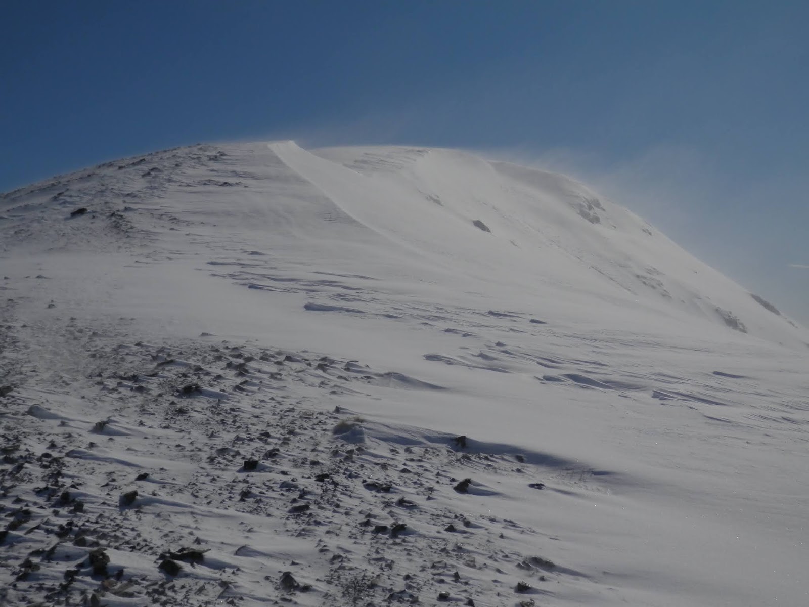
Things changed about halfway up the mountain, somewhere around the 1300m contour, when a strong nor'west wind blew up unannounced (and un-forecast!). Powder snow was being blasted across the broad ridge which while not quite blizzard-like certainly made for a far more wintry feel. The wind-driven powder pelted my legs, arms, and, at times, face with such force that it felt a little like being blasted by tiny hailstones. Despite this, it did make a rather beautiful scene, with the fine particles of snow streaking across the snow slopes on the wind. My attempts to capture this effect on camera don't really convey how I saw it in person, but you may get the idea anyway when you see them.

Continuing on, after taking a moment to decide whether it was prudent to continue, soft, deep snow drifts between around 1300m-1550m slowed me down as I sank in to my thighs most steps. Yes it was tiring but was it fun...oh YES!!!
As I climbed higher, gaining the more exposed upper slopes, evidence of the regular winds that pummel the area came in the form of a stripped back, consolidated snow pack, the freshly fallen powder having been blown well off the ridge. Although a little icy in places, the firm snow offered quick, easy travel up the final 200m of altitude, the only obstacle now being the ferocious wind that was strengthening seemingly with each step.
I quickened my pace, keen to reach the summit and hopefully find a sheltered spot for a quick bite and to take in the all encompassing views. For those visiting Foggy Peak for the first time be warned that there are a couple of false summits, but the true one is definitely worth the toil required to reach it as the views are superb! On a good day, Aoraki/Mt Cook can be seen in the distance. This, however, was not a good day, and despite my efforts to hastily build a snow wall for a bit of shelter, the wind made the summit a rather unpleasant place to linger. With cold setting in as soon as I stopped moving, a few quick photos were snapped before I beat a humble retreat.

In order to escape the weather as quickly as possible, I took a more direct line down the ridge, taking care on the upper slopes to avoid a slip on the icy patches, before plunging into the softer snow lower down. Good fun!
Interestingly, conditions were still perfect down at the car - sunny and almost dead calm - and the numerous sightseers on the pass were blissfully unaware of the wind that raged several hundred metres above them. A good reminder to always travel prepared!


Wind sculpted snow on the lower slopes of Foggy Peak

Wind sculpted snow on the lower slopes of Foggy Peak

Lake Lyndon from about halfway up Foggy Peak, with an indication of the steepness of the climb

Southern end of the Craigieburn Range - Porters Ski Area to the left, Mt Enys (2194m) rear right

Snow being swept across the upper slopes created an interesting visual effect

An attempt to capture the wind blown snow

Spindrift blowing off the summit ridge of Foggy Peak

Just below the summit in a calm moment with peaks of the Torlesse Range all on show, from Castle Hill Peak (1998m) round to Mt Torlesse (1961m), with Red and Back Peaks in between

Lake Lyndon from near Foggy Peak summit, with Mt Hutt and the Rakaia valley behind

This photo doesn't convey how cold it was on the summit, with snow and wind blasting me


Access: Take SH73 towards Arthur's Pass and park at the top of Porters Pass. 

Time: Porters Pass to summit 1hr 45mins, return 50mins

Map: BW21 Springfield

Hut: None

8 September 2016

Mt Sunday, Hakatere Conservation Park - 9 July 2016

While not physically demanding, a trip to Mt Sunday is still a worthwhile outing. The drive on its own is an experience to savour as it passes through first the beautiful Ashburton Lakes region before taking you deep into the majestic Canterbury high country.

Our 7 year old, Lincoln, had been champing at the bit to go on his first 'solo' tramp with me, so Mt Sunday was chosen to suit his little legs, enabling him to climb a mountain as per his request. The views on offer were enough to interest me, on top of the enjoyment of a day out with my son.

We set off early on a fine, frosty, blue sky morning. I resisted the usual coffee stop at the Mt Somers Store, saving that for the trip home when an ice cream might be in order, and we forged our way inland. The road seal ended at the historic Hakatere Station buildings and here we had the choice of turning right, which would take us to Lake Heron, and to continue on ahead. The latter was where we needed to go so on we went. The gravel road is wide and well maintained, perhaps an indication of the level of traffic it receives, and we cruised along quite happily through the Ashburton Lakes, passing first Lakes Emma and Roundabout (not visible from the road) and then on past Lake Camp and Lake Clearwater with its' collection of baches.

Beyond the lakes the road was a little rougher but still good and as we rounded Harpers Knob the best view of the drive was revealed - the broad expanse of the Rangitata River and on up the Havelock Valley, with Mt D'Archiac rising like a great white tooth in the upper valley.
Mt Sunday was not too far from here and we were soon in the carpark ready to set off, but not before we'd stopped to meet some friendly horses near Mt Potts Station.

The tramp itself is a straightforward stroll, initially along a vehicle track in the riverbed (damp in places). Poles mark the route and trampers are asked to stick to the poled route as the surrounding land is private. A footbridge across a small braid of the river enabled us to keep our feet dry, then a little further on a larger, and swifter, braid was encountered. Here a swing bridge has been constructed, as well as some information panels. Lincoln endeavoured to spot one of the fish the panels mentioned but the water was flowing far too swiftly to allow him to see anything much.

Once across the bridges, a short wander across grassland led us to the base of Mt Sunday. Here the climb began, it was short but moderately steep with the occasional frosty section to keep us on our toes. Lincoln practically skipped up though and was soon approaching his first summit, a modest one yes, but still an achievement.

The location of Mt Sunday, set down in the riverbed, gives one the feeling of being in an amphitheatre of peaks, with high ranges on all sides. Up the valley, the Havelock and Clyde Rivers marched down from the Southern Alps, merging just upstream from Mt Sunday to form the Rangitata River. On one side of the valley sits Mt Potts, while over 6km away across the valley the Black Mountain Range rises. It was an alpine spectacle to just sit and savour, which we were more than happy to do while enjoying lunch at the same time. It was a small taste of what Sunday lunches for the mustering gangs and their families would have been like, although given the Rangitata's reputation for wind I'm sure that not all their meetings would have occurred in such benign conditions. That warning stands for visitors - be prepared, as Mt Sunday is completely exposed to the elements.

With lunch over there was little more to do than take a few photos of each other before making our way back to the car, and of course that ice cream stop at Mt Somers!

The upper Rangitata River and the view up the Havelock Valley
Stopped to say hi to these two, near Mt Potts Station

Lincoln couldn't help but stomp his way through the frozen puddles

Crossing the footbridge, Mt Sunday is the rocky lump in behind

Looking for fish in this swift braid

Following along the backbone of Mt Sunday

Reaching the summit of Mt Sunday

Great spot for lunch

Looking up the Clyde Valley

Rangitata headwaters - Havelock River (left) and the Clyde heading off to the right

Looking across the wide Rangitata valley to the Black Mountain Range

The view up the Havelock River to Mt D'Archiac (2875m)

Cloudy Peak (2403m), viewed from the summit of Mt Sunday

Our moment on the summit

Lincoln's turn with the camera!

Wouldn't be a visit to a trig without a pose beside it!

Starting our descent

The rock bluffs of Mt Sunday

Crossing back over the swing bridge

Parting shot as we head back to the car


Access: From Mt Somers Village head inland on Ashburton Gorge Rd. At the historic Hakatere Homestead the road changes to gravel. From here, continue straight ahead, passing Lakes Camp and Clearwater before crossing the Potts River (bridged). The Mt Sunday carpark is signposted a little further along the road. If you reach Erewhon Station at the end of the road, you've gone too far! 

Time: Carpark to summit 45mins (at a leisurely pace)

Map: BX18 Lake Clearwater

Hut: None