"You will go out in joy and be led forth in peace; the mountains and hills will burst into song before you" - Isaiah 55:12
Showing posts with label Korowai/Torlesse Tussocklands Park. Show all posts

3 May 2020

Foggy Peak, Korowai/Torlesse Tussocklands Park - 27 August 2019

Keen to get out and stretch my legs again, I headed for a familiar spot - Foggy Peak. I've been up Foggy a couple of times before, once before dawn to catch the sunrise, and again en route to Castle Hill Peak further along the ridge. Neither of those trips were in winter however so this trip held the appeal of a new experience of climbing the peak and enjoying the surrounds while blanketed by an attractive winter coat of snow.

Access is simple - take SH73 to Porters Pass, stop at the top of the pass, get out, and start heading uphill. It's a steep slog, with little respite, but by driving to the top of the pass you reap the benefit of having gained much of the altitude by car, although there's still 800m of height gain needed to reach the summit. Not a mountain to be underestimated, especially in winter when the ridge (being on the southern aspect) can be very icy, Foggy Peak presents an achievable challenge for those willing to slow down, stop the car, and explore.

Fresh snow on the pass greeted me as I left the car, a sign that caused me to glance up at the upper slopes, trying to determine how much may have fallen up there. Not easily put off, especially having made the effort to drive there, I shouldered my pack and set out. Conditions were idyllic - sun shining, and a very light breeze, all in all an absolutely stunning winter day...for now!!
It was easy going through the alpine scrub on the lower slopes, with around 6 inches of fresh powder snow underfoot, and I snaked my way ever upwards, at times following the prominent foot trail that led from pole to pole, and at others taking a more direct line.
Things changed about halfway up the mountain, somewhere around the 1300m contour, when a strong nor'west wind blew up unannounced (and un-forecast!). Powder snow was being blasted across the broad ridge which while not quite blizzard-like certainly made for a far more wintry feel. The wind-driven powder pelted my legs, arms, and, at times, face with such force that it felt a little like being blasted by tiny hailstones. Despite this, it did make a rather beautiful scene, with the fine particles of snow streaking across the snow slopes on the wind. My attempts to capture this effect on camera don't really convey how I saw it in person, but you may get the idea anyway when you see them.

Continuing on, after taking a moment to decide whether it was prudent to continue, soft, deep snow drifts between around 1300m-1550m slowed me down as I sank in to my thighs most steps. Yes it was tiring but was it fun...oh YES!!!
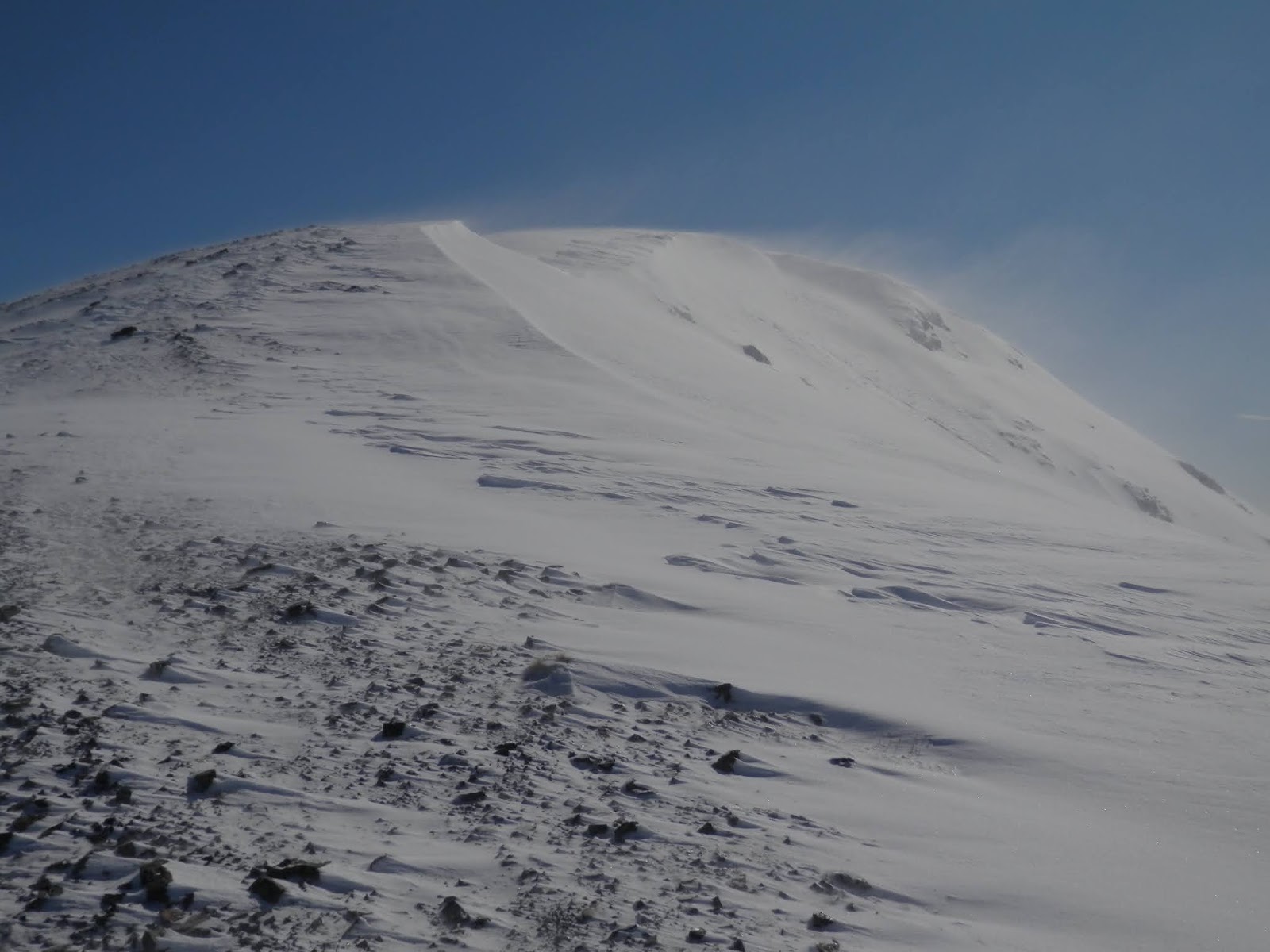
As I climbed higher, gaining the more exposed upper slopes, evidence of the regular winds that pummel the area came in the form of a stripped back, consolidated snow pack, the freshly fallen powder having been blown well off the ridge. Although a little icy in places, the firm snow offered quick, easy travel up the final 200m of altitude, the only obstacle now being the ferocious wind that was strengthening seemingly with each step.
I quickened my pace, keen to reach the summit and hopefully find a sheltered spot for a quick bite and to take in the all encompassing views. For those visiting Foggy Peak for the first time be warned that there are a couple of false summits, but the true one is definitely worth the toil required to reach it as the views are superb! On a good day, Aoraki/Mt Cook can be seen in the distance. This, however, was not a good day, and despite my efforts to hastily build a snow wall for a bit of shelter, the wind made the summit a rather unpleasant place to linger. With cold setting in as soon as I stopped moving, a few quick photos were snapped before I beat a humble retreat.

In order to escape the weather as quickly as possible, I took a more direct line down the ridge, taking care on the upper slopes to avoid a slip on the icy patches, before plunging into the softer snow lower down. Good fun!
Interestingly, conditions were still perfect down at the car - sunny and almost dead calm - and the numerous sightseers on the pass were blissfully unaware of the wind that raged several hundred metres above them. A good reminder to always travel prepared!


Wind sculpted snow on the lower slopes of Foggy Peak

Wind sculpted snow on the lower slopes of Foggy Peak

Lake Lyndon from about halfway up Foggy Peak, with an indication of the steepness of the climb

Southern end of the Craigieburn Range - Porters Ski Area to the left, Mt Enys (2194m) rear right

Snow being swept across the upper slopes created an interesting visual effect

An attempt to capture the wind blown snow

Spindrift blowing off the summit ridge of Foggy Peak

Just below the summit in a calm moment with peaks of the Torlesse Range all on show, from Castle Hill Peak (1998m) round to Mt Torlesse (1961m), with Red and Back Peaks in between

Lake Lyndon from near Foggy Peak summit, with Mt Hutt and the Rakaia valley behind

This photo doesn't convey how cold it was on the summit, with snow and wind blasting me


Access: Take SH73 towards Arthur's Pass and park at the top of Porters Pass. 

Time: Porters Pass to summit 1hr 45mins, return 50mins

Map: BW21 Springfield

Hut: None

22 January 2016

Kowai Valley, Korowai/Torlesse Tussocklands Park - 14-15 January 2016

Initially we had planned to take the kids up the Hawdon Valley, taking the tents for a nice riverside overnight camp. However with strong nor'west winds forecast, bringing rain along the Divide, we opted for a trip further east. While not escaping the wind, this gave us a better chance of staying dry, an important consideration for our 2 families with 6 young kids.

The Kowai Valley was our destination. It's a valley I've visited twice previously, on trips to The Gap and to Mt Torlesse, so I knew the kids would handle it fine.
We set off early afternoon on a rather hot, sunny day. Entering the valley, we followed along a well formed vehicle track which led along a terrace above the river. This made for easy going, the only hardship being the heat beating down on us. Along the way we met a couple of guys on their way back out after a stay up at the hut. One of the faces looked familiar, and it turned out to be a fellow we'd bumped into on our way to The Gap. On this occasion the two of them had been up at the hut starting renovations, a plan to revamp the hut being undertaken by members of the Permolat group (see here for more info on the group, and also the link on the right hand side of the page). The overhaul will make significant improvements to the  hut space, so I look forward to visiting in the future to check it out.

The vehicle track led us down to the river, descending at a collection of beehives, but shortly before we got there we came across a chap parked up in a van with 3 dogs. Odd sort of place to be, and we moved on past, but one of the dogs decided to follow us...and didn't leave us until we returned the next day! The extra company kept the kids occupied on the walk which took their minds off the walking somewhat.
At the beehives we dropped down the bank to the river. A large slip has come down here since my last visit, creating some confusion on my part. I decided to scramble up the slip as it appeared there was a track cutting across it a short distance up. This proved correct, so we all climbed up and followed the high track along, needlessly as we discovered on our way back as the main track can be picked up lower down by wandering along the river gravels for maybe 200m or so. Also, the scramble back up the slip can be avoided by staying up on the terrace and following a foot trail in behind the beehives. I had deliberately avoided this as the bees were very active at the time we passed by.

From that point on, the tramp was fairly straight forward. We passed through a short pocket of bush, which provided some welcome respite from the sun, before climbing over a small knob mid-valley. A short descent through nicely cut back broom (thanks to those who are maintaining this as I remember it being a tight, scratchy section through here) took us down to Foggy Stream.
It was slightly slower going beyond there, as travel was on the river gravels of the main river, but soon the welcome sight of the hut and surrounding buildings came into view, generating much excitement in the ranks.

John Hayward Memorial Hut, or Kowai Hut as I've always known it, was built in 1973 by a research arm of Lincoln College (now University). Scientists used the hut as a base for studying hydrology and erosion in the valley, and the hut is named in memorial to John Hayward who was heavily involved in the work. From my previous experiences in some of the more rugged parts of the catchment, I can certainly see why those chose to study erosion here as the many small streams are heavily eroded, and following them often leads to one becoming bluffed with the choice of retracing your steps to find a better route, or climbing out on completely rotten, sodden rock! With that in mind, the best routes onto the tops are definitely by way of the ridges and spurs.
The hut presently has 4 bunks, although plans are afoot (and have begun as mentioned above) to increase that to 6 bunks.

We set up camp on the terrace next to the hut, thereby being able to use it as a site for cooking, a much safer alternative to lighting our stoves outside where things are rather dry.
After pitching tents and settling in, it was off to the river for some evening fun. It was glorious in the sun, the kids delighting in the natural playground on offer. Us adults set about building a dam (always good fun!) which created a nice pool above it.
All too quickly it was time to head back. The dry conditions scuppered the kids idea of a campfire with marshmallows, so instead we heated them over one of the gas cookers.
Evening drew in, the last of the light fading to darkness, so into the tents we went, but not after a spot of star-gazing. Iain and I were tempted to sleep out under the stars, but with a nor'wester forecast there was no guarantee it wouldn't rain, so we retired to the tents also.

The forecast wind arrived, building as the night went on. Although not excessively strong, it made for a noisy night in tents, and little sleep was had by most.
The morning dawned grey, with cloud spilling over the tops. With rain due later in the day, we set off early and made steady progress back down the valley, aided in part by the tail wind and perhaps by lighter loads (for some anyway).
After a quick morning tea stop mid-valley, it was plain sailing back to the car, stopping to tie up 'Spud' along the way.

A memorable family tramp, with hopefully many more to follow.

Ready to go

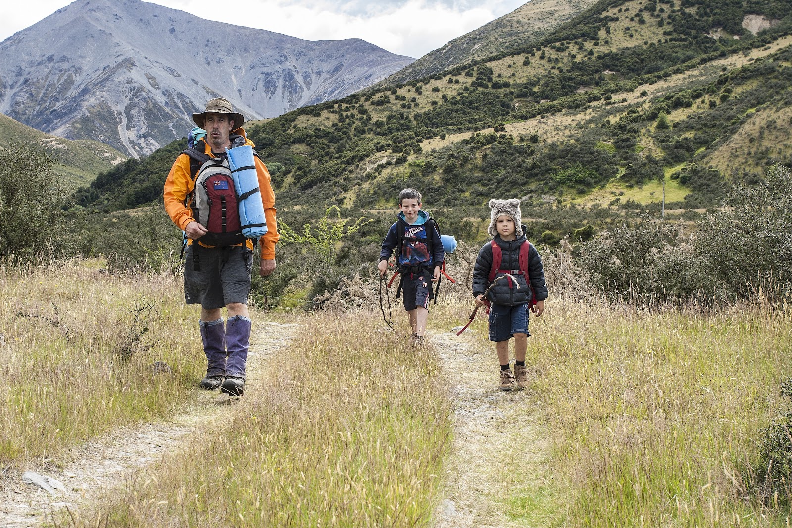
Easy tramping up the valley

Kids & water - a recipe for fun!

The high route over the slip in red. This is unnecessary if you follow the blue line and up the riverbed a short distance 

Mt Torlesse (1961m)

Looking up the Kowai River to Mt Torlesse

Finally found some shade for a snack

Hoisting the pack back on wasn't much fun, but was fine once on the back

Climbing the small bump mid-valley

Mt Torlesse - the line I climbed in 2015 visible here as I climbed to the saddle on the right then up and along the south ridge (skyline). It's a long route, but fairly easy

Having fun as we near our camp site

Slow and steady over slippery rocks

The kids took the lead, lost the trail, and discovered matagouri!

Climbing up to the terrace that houses the hut

Sam (5), Iain, and Beth arrive

The hut on its' terrace, looking back down the valley

The hut on its' terrace, looking back down the valley

Remnants of the hydrology studies carried out here in the 1970's

Campsite in the Kowai Valley, with The Gap and Red Peak in the background

Rugged section of the Torlesse Range from The Gap round to Red Peak

Daniel, Lincoln, and 'Spud', our surprise companion

Evening fun in the river

Kowai River and Red Peak (1853m)

Julia beneath Mt Torlesse

Girls just wanna have fun!

Time to cool off

Lincoln delighting in the fact he's just fallen in!

Last light touching the summit of Mt Torlesse

Sunset from the Kowai Valley

View from the tent

We're greeted by cloud being blown over the tops the next morning

Group shot at John Hayward Memorial Hut

Leaving camp, Spud still in tow 
Wild flowers alongside the Kowai River

Foggy Stream, with Foggy Peak (1741m) on the left in the distance

Snacking on our way out

Passing the large slip, which we crossed halfway up the day before


Final view up the valley to Mt Torlesse before legging it out along the vehicle track

The lads striding out

Crown Copyright - Land Information NZ


Access: Follow SH73 through Springfield, then as you near the start of the climb to Porters Pass, look for a layby under a group of large trees opposite the old roadman's hut.

Time: Carpark to hut 2hr 30mins (typical time 1hr)

Map: BW21 Springfield

Hut: John Hayward Memorial Hut (4 bunks, private, contact Brooksdale Station)