A long weekend and a fine weather forecast...ingredients that make an overnight tramp a winning recipe.
After giving Julia a couple of options, it was agreed to head for the Lewis Tops, a trip I'd been keen to do for some time, having driven the highway countless times over the years.
Most people park at the well known St James Walkway carpark, located right on Lewis Pass itself. The track starts across the road and about 100m up the road from the carpark. However, this carpark is prone to vandalism (as we experienced when doing the
Zampa Tops trip) so I was reluctant to park there overnight. Fortunately there's another option, if you're in the know, located at the summit of the highway, and it was here that we parked.
The track used to start from here, and that section still remains and links up with the main track so this is still a good option.
Leaving the car we set off into the bush. Initially the track was rough as it's no longer the main track but was easily followed, and in only 5 minutes we had joined the main track. Vibrant, soft mosses lined the track, making it delightful walking as we sidled round for a short distance before starting the climb proper.
It was quite a steep climb up through the bush, with very little respite, and made for quite slow going on what had become a rather hot afternoon. After about 20 minutes there was a break in the bush cover, allowing decent views across the valley - a hint of what was to come higher up. This break helps to form a lookout of sorts, and would make a good option for walkers just wanting a very short stroll up to take in the views on offer - there's even a seat at the end of a short side track!
Thankfully it was only a short break, and we happily plunged back into the shade of the bush as we made our way up.
It became evident that quite a few others had had the same idea as us. We passed a couple quite early on, carrying their 2 and a half year old up for a night out on the tops. As we made our way up, our numerous stops meant others caught us up, and so we discovered there were 14 of us spread out through the bush. As it turned out, we were all moving at quite a similar pace, and so kept passing each other as each group took their turn at stopping for a breather.
The highlight of the climb through the bush would have to be seeing a kea taking a tree to task. We stood for several minutes watching, enjoying seeing the bird in a different way than we'd seen them in the past. We were surprised, although shouldn't have been given it was a bird!, at how nimble it was hopping from branch to branch, all the while gnawing away on the trunk, oblivious to its' captivated audience (or was it putting on a show for us?).
After 90 minutes we reached the bushline. Any concerns over it being blazing hot were quickly dispelled, as a lovely cool breeze was blowing over the tops, balancing the heat of the sun.
Above bushline the climbing continued, as we set off up a steep face that rose wall-like in front of us. Once at the top the gradient eased. I for one was pleased, having assured Julia it would once out of the bush, but we weren't done yet. A series of knobs had to be passed until finally we topped out on the highest one - Pt 1568m.
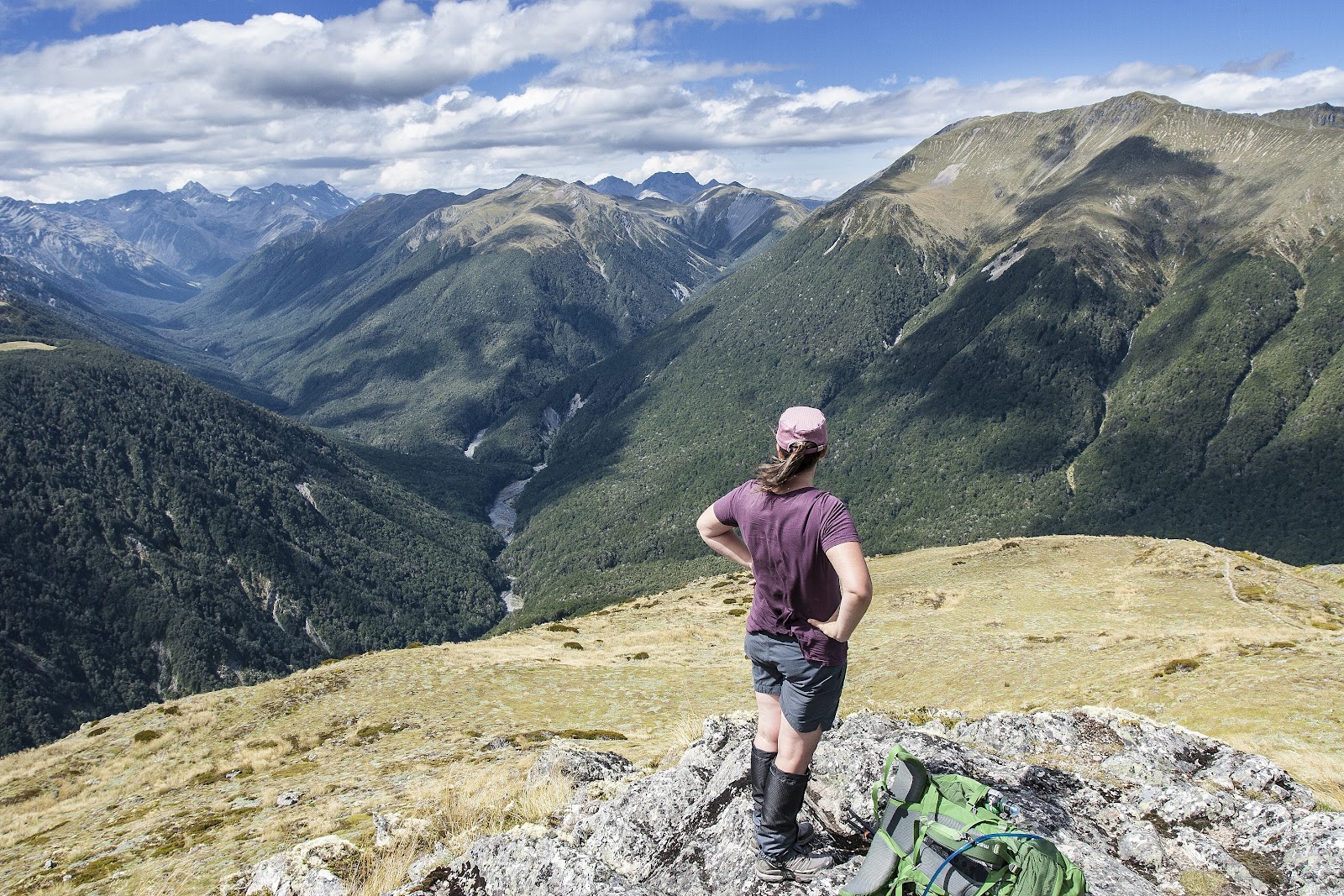
The views were all encompassing. Being the highest point along the ridge, a 360 degree panorama unfolded around us, sweeping round from the Freyberg Range to the north, to the Spenser Mountains, the Opera and Libretto Ranges, and round to Mt Technical and The Apprentice further along the Lewis Tops. Away to the west in the distance we could make out the Paparoa Range, beyond which lies the West Coast.
Once over Pt 1568m, the route was a delightful amble across undulating tops. A short distance beyond Pt 1568m lay the first tarn along the tops. Although it's a reasonable size, and looked beautiful, it sits quite a way below the main ridge so I was hoping to continue on to a larger tarn, which Julia was happy to do.
After passing a couple of very small tarns nestled in a slight depression along the ridge, we passed over Pt 1561m and there was our tarn, sparkling in the afternoon sun. It looked a glorious spot so we dropped down off the ridge to scout out a campsite. There were several lovely spots on offer, but we chose almost the ultimate in backcountry real estate - a spot on the tip of a small finger of land jutting out into the tarn. It meant we had water on all sides which was pretty nice.
We set up and whiled away the afternoon in the sun drinking coffee, taking photos, and just soaking up the tranquility of the place. Despite the fact that there was several parties on the same route we had the tarn to ourselves - one of the joys of there being a tarn in nearly every hollow along the tops, everyone was able to enjoy their own space.
As evening closed in, so did the cloud. We watched it slowly spilling over the tops of the Libretto Range, before it found its' way to us. The drop in temperature, and the dampness of the cloud, sent us into the tent, retiring early for the night.
Opening the tent door the next morning saw us greeted with a truly majestic scene. The evening cloud had cleared, leaving a serene yet moody landscape, the brooding skies reflected in the still waters of the tarn.
We spent a good hour or so wandering round, watching the day begin to reveal itself, before returning to the tent for breakfast and then to pack down.
The return trip was a delight in the cool of the morning, although by the time we started to descend off Pt 1568m down to the bushline the heat was becoming noticeable.
This descent illustrated how steep the climb up had been. While I didn't notice it so much going up, when faced with descending the true nature of the terrain was revealed. Once back in the bush though we made fast time, reaching the car 40 minutes after entering the bush.
A glorious trip, the Lewis Tops on a fine day are a trampers paradise and well worth the effort required to reach them.
 |
| Vibrant mosses line the lower part of the bush track |
 |
| First views across towards the Freyberg Range |
 |
| Julia gaining height |
 |
| Climbing above bushline, Trovatore (1737m) across the valley |
 |
| Up the steep face we go, with Cannibal Gorge running away in behind |
 |
| Reward for all the climbing |
 |
| Looking across to Mt Freyberg (1817m) |
 |
| The first tarn, below the ridge between Pts 1568m and 1561m |
 |
| Cruising along the tops |
 |
| A couple of small tarns along the ridge |
 |
| Looking west down the Maruia River |
 |
| Our home for the night, with Mt Technical (1870m) rising behind |
 |
| Approaching the tarn we camped beside, with the Lewis Tops rambling on ahead of us |
 |
| Sweet campsite at 1500m |
 |
| Time for a cuppa! |
 |
| Relaxing in the afternoon sun |
 |
| Looking along the Lewis Tops to The Apprentice (1678m) |
 |
| Alpine flowers grow abundantly here |
 |
| Dinner prep on a glorious evening |
 |
| A wonderful spot in the late evening light |
 |
| Cloud starting to spill over the Libretto Range... |
 |
| ...and soon over our way too. |
 |
| A moody yet serene scene welcomed us as we opened the tent |
 |
| Campsite on a peaceful morning |
 |
| Looking down into Deer Valley below us, and along the Lewis Valley |
 |
| First rays of sun as it rises over the Libretto Range |
 |
| The sun starting to show through the cloud |
 |
| Wonderful sun rays across the valley |
 |
| A great morning to be in the mountains |
 |
| Sun kissing the tops of the Freyberg Range as we look on from a field of alpine flowers |
 |
| Looking west down the Maruia Valley at dawn |
 |
| Sun bursting through the cloud above the Libretto Range |
 |
| Sun bursting through the cloud above the Libretto Range as we return for a cuppa |
 |
| Weta |
 |
| Leaving the tarn, our campsite was at the end of the finger of land out in the tarn |
 |
| The Lewis Tops, with some others spots visible |
 |
| An indication of the sheer drop down on the Maruia side |
 |
| Passing the first tarn again on our way back up to Pt 1568m |
 |
| Trovatore (1737m) and Travers Peak (1724m), seen from Pt 1568m |
 |
| Looking down the line of the Lewis Pass Highway, with the Libretto Range marching off into the distance |
 |
| Maruia River Right Branch |
 |
| Crown Copyright - Land Information NZ |
Access: Drive on SH7 to Lewis Pass and either park at the main signposted carpark or at the hidden layby at the summit of the road.
Time: Carpark to bushline 1hr 30mins, bushline to campsite 1hr, return 1hr 40mins
Map: BT23 Lewis Pass
Hut: None