"You will go out in joy and be led forth in peace; the mountains and hills will burst into song before you" - Isaiah 55:12
Showing posts with label Craigieburn Forest Park. Show all posts

15 February 2015

Mt Bruce, Craigieburn Forest Park - 24 January 2015

I had been eyeing up Mt Bruce for a while, as it makes for an excellent day trip and is not too far from home. In addition, my Arthur's Pass mountaineering guidebook describes the view from the summit as 'legendary', so with an endorsement like that I just had to check it out!

The forecast for the day was for a scorching hot afternoon, so I made an early start, leaving home at 4am, which, all going to plan, would see me reaching the summit around 8.30-9am, still in the nice coolness of the morning.
It was still dark as I left the carpark at Cora Lynn so I set off by torchlight. About 2 minutes along the trail lies Bealey Hut. Built in 1960, it's still reasonably tidy despite its' proximity to the road end, which often makes huts prone to vandalism. It boasts 6 bunks, and offers an option for those who may be looking to get an early start on the Cass-Lagoon tramp, or even an accessible night in the bush for those not so inclined to walk for hours to reach a backcountry hut.

After planting a Bible and leaving my intentions in the hutbook, I started on the climb up through the bush towards Lagoon Saddle. This section of track is part of the popular Cass-Lagoon Saddle tramp, a superb 2 day tramp through the area (see report here), and also part of Te Araroa Trail, the nation-long walk through New Zealand. As such, it's a well maintained track that climbs moderately steeply through the standard Canterbury beech forest until at around the 950m contour it cuts across through a section of pine plantation. This made for a pleasant change to the beech, as I found myself walking on a nice carpet of pine needles - a far cry from the twisted roots that the beech trees often present underfoot.
The track made for fast travel, and in the dark I didn't really notice the altitude gain so much, so after an hour I found myself at the bushline just as the sun was casting its' first golden rays onto the mountains around. These were the first views of the tramp, and gave a taste of what might be to come as I got higher up the mountain. The photos probably don't so the scene justice...as with so many things it's much better to be there and experience it yourself.

My original plan was to head straight up the tussock slopes from the edge of the bush, then follow the  east ridge to the summit. As I gazed up at the route I started to have some doubts, as there appeared to be some deeply incised gullies further up the mountain. From my position, I couldn't tell if I would be able to get across them higher up so made the decision to continue along the track towards Lagoon Saddle and approach the summit from the easier angled slopes on the northwest aspect of the mountain.
A quick ramble along the track, in and out of a series of small gullies that on our previous trip had seemed never ending at the end of a long day, soon had me where I wanted to be and I suddenly realised that every step was now taking me further away from my goal - it was time to leave the track and enter the tussocks.
My chosen exit point was probably, in hindsight, not the best choice, and I made a short, steep climb over a bump in the slope before reaching a nice flatter section to pause and survey the route ahead. The tussocks on this short climb made for tiring work, especially on the legs, as at times I was pushing through waist high grasses, but this was short lived and higher up the mountain they were much more stunted and easily travelled.

I took a moment on the flat section to plan my route. The summit was guarded by much steeper slopes, and some small bluffs and rock outcrops, and in places the grass slopes were replaced by steep, rocky sections. I figured it would be easier to skirt up along the edge of the rock slopes, and avoid having to traverse across them, so scouted a route that angled up under the largest rock outcrop then straight up on a mix of grass and rock to gain the short summit ridge. This proved successful and although I had now slowed a little, thanks in equal parts to the earlier draining section of long tussocks and to the fact I hadn't had breakfast, I soon found myself stepping out along the summit ridge with the large summit cairn in sight only metres away. A short wander along the ridge and I was there, on top of Mt Bruce.

The views as I reached the summit were stunning, with the peaks of the upper Harper catchment suddenly appearing, complementing those already on show across towards Arthur's Pass and into the Waimakariri headwaters, where prominent peaks such as Mts Harper and Speight looked stunning.
I spent around 45 minutes on the summit, soaking it all in while I had some breakfast, took photos, and looked for routes to do on future trips. The terrain on the other side of Lagoon Saddle looks inviting and may well require a visit in the future!

I had several options from the summit. The obvious one was to retrace my steps - an easy option but probably the least interesting. Secondly, I could take the east ridge (my original planned route) and look for a way back down to the bush edge and track back to my car, hoping that from above I could pick out a decent route down. This would still have meant heading back down the same bush track and as I'm always keen to tread new ground, and had plenty of time, I went with option 3: a descent to the saddle south of Mt Bruce then from there to follow Broad Stream out to the road, coming out about 2km from my car. I had read and seen a recent report that there is a track down through the bush in Broad Stream, which would offer reasonable travel until the stream bed widened out lower down.
The descent to the saddle, which is known informally as Harper Saddle (at BV20 873316 - not marked as such on the current Topo50 map, but signs in Broad Stream call it by name), looked good, with plummeting scree slopes offering fast travel down to the tussock covered saddle. It was quite steep at the top, requiring a bit of care, then the angle of the slope eased slightly. The quality of the scree however was mixed, with sections of lovely soft stuff lasting just long enough for me to relax and enjoy it, before I would then hit a patch of horrible hard ground with a bare covering of loose rock. After a couple of near slips on these patches I decided to just take it slow and steady, and made it down to the saddle, which sits at around 1360m, unscathed.

From here it was back into the tussocks, stepping in and out of unseen potholes and over uneven ground - the usual hazards of travel in such terrain, and set off down the true right of the stream draining the saddle. I quickly tired of stepping into holes, so made my across onto a scree slope and sidled across that until I reached the bush.
I wasn't sure if the track entrance was marked or not, and my route across the scree saw me entering the bush higher up than I should have been. As I entered, following what was at first glance a track of sorts, it soon became apparent that I'd missed the mark as the "track" quickly petered out and I found myself bush-bashing. Knowing I had quite a way to go down to the forks in Broad Stream I decided to head left towards the stream, basing this decision on the fact that the track should be between me and the stream and I would intersect it somewhere along the way. Sensible logic...and it proved correct as after 5 minutes of solid bush-bashing I found the track. Then I saw the totally unexpected sight of a DOC orange triangle track marker - I'd known of the track's existence but didn't realise it was an old DOC track. Buoyed by this, and the fact that now that I was on the track things would be straightforward from here on out, I picked up the pace.

The track followed down a small spur between 2 small stream branches, then at the first small forks it crossed to the true left for most of the way down to the main fork in Broad Stream (at BV20 895327), with the odd crossing here and there. It's easy going, the track is well marked but is slightly overgrown as it's no longer maintained. Broad Stream is quite narrow, and would be slow going if you were to try and make your way down the stream itself - find the track and follow it!!
Below the forks the track continued in much the same vein, crossing where bluffs force it to. The further down stream I got, the better the track became. As the stream began to open out cairns started to appear and the track gave the appearance of one that gets quite a bit of use. Perhaps the owner of Cora Lynn Station has done some work in the lower reaches of the stream, offering easy walking options for visitors to their Wilderness Lodge, as in places the sides of the track are lined with stones, giving the track a path-like feel and look to it.

By now it was hot, and I was very tempted to try and cut across the back of Cora Lynn directly to the carpark. However, those sort of antics don't endear trampers to local land owners, so I kept my line along the bank of the stream, following the fenceline all the way out to the road. It had taken around 3hrs from Mt Bruce down to the highway, and all that was left was to leg it back along the road and up the drive to the car. I was hopeful of hitching a lift but all I got was a friendly hello from a passing cyclist. I got back to the car around 12.45pm, making it a 7hr round trip including my time on the summit, and I was pleased I'd made the effort to get an early start - it was going to be a blazing hot afternoon.

A fantastic day out in a beautiful part of the country, and one that has inspired further exploration in the area.


Reaching the bushline as the first rays of sun strike the mountains

First light on Mt Rolleston (2275m, back right of image) and surrounding peaks

Looking up the Bealey River where it joins the Waimakariri (foreground)

Early morning sun hits Dome (1945m)

View down the Waimakariri River, Dome at left

View from bushline - Jellicoe Ridge (far left), Mt Rolleston (rear, left of centre), Mt O'Malley (right of centre), looking towards Arthur's Pass

Looking up towards Mt Bruce, from the track across its' lower slopes

In the tussocks, early in the climb to Mt Bruce

Views become more expansive 
Mt Bruce (1630m), guarded by steep upper slopes

My route up through the bluffs and rock outcrops, surveyed from the flatter section I stopped at


Waimakariri headwaters, from the upper slopes of Mt Bruce

View down the Waimakariri, from the upper slopes of Mt Bruce

Lagoon Saddle

False summit cairn on Mt Bruce, the true summit is not far away though, and the many peaks of the Waimakariri headwaters and western Arthur's Pass National Park

Looking up the Bealey River. Mt Rolleston (with Crow Glacier visible just below its' summit, left), Mt O'Malley (centre), and Mt Oates (right rear)

Summit cairn on Mt Bruce 

East Ridge of Mt Bruce, with the Waimakariri River beyond

Saddle 1360m (Harper Saddle), and Pt 1672m on the Black Range 

Upper Harper River and Long Creek peaks - Packard Peak (2066m) far right

Dome (1945m), taken from the summit of Mt Bruce, with Mt Oates (2041m) rear, left of centre

On the summit of Mt Bruce, backed by the Waimakariri

L to R: Mts Greenlaw (2315m), Speight (2116m), and Harper (2222m) - (I think!!, not completely sure which is which through the middle)

Mt Rolleston (2275m)

Dome (1945m), and Mt Oates (2041m) at rear

Area around Arthur's Pass village (located in the valley heading up to the left, centre image)

Waimakariri River, with Bealey Spur & tarns in front, Turkey Flat (the obvious fan in the river bed), and the Crow Valley upper right

Packard Peak at the head of Long Creek, Mid Hill rising out of frame on the right - looks like good terrain to explore

Looking down into Broad Stream as I descend from Mt Bruce to the saddle

Huge scree slopes typify the area, Packard Peak at rear

Looking down Broad Stream from the saddle at 1360m

Looking back up at Mt Bruce as I start to descend Broad Stream, saddle at left

The track down Broad Stream

The track (slightly overgrown) down Broad Stream

Bridge across Broad Stream - wasn't sure if it would hold me (it did!)

Bridge across Broad Stream - wasn't sure if it would hold me (it did!)

Do I...or don't I???

Mt Bruce (1630m), seen from the highway near Broad Stream. Note the pine plantation

Crown Copyright - Land Information NZ


Access: Follow SH73 towards Arthur's Pass. Turn left at the Cora Lynn Wilderness Lodge sign and follow signs to the car park.

Time: Car park to bushline 1hr, car park to summit 3hr 15mins, summit to road via Broad Stream 3hrs

Map: BV20 Otira

Hut: Bealey Hut (6 bunks)

17 June 2013

Helicopter Hill, Craigieburn Forest Park - 26 September 2011

This was a pleasant, short day trip with my wife, Julia. We grabbed the opportunity for a bush walk while on a week off work, and the fact that we needed to be back to pick up kids from school dictated a short walk. There is a network of short tracks branching off the Broken River and Craigieburn Valley ski field access roads, giving numerous options for those looking for a quick escape to the hills. We chose the track to Lyndon Saddle for our trip, with the small extension of a short climb onto Helicopter Hill from the saddle promising views of the main Craigieburn Range while enjoying lunch in the sun. Recent snowfall made the trip all the more appealing, albeit cold in the shade of the bush.

The track itself was a pleasure to walk, gently winding its way up through the bush to Lyndon Saddle. The saddle is unmarked on current maps and is located NW of Helicopter Hill at grid reference BW21 963232, recognisable as it is at the major track junction marked on the map.
Heavy snow had fallen the day before our tramp and, despite being well below the bushline, snow carpeted the entire track. Ours were the first footprints of the day, unless you count the numerous trails left behind by various birds and other animals. These trails through the snow made for an interesting walk, and it really was quite remarkable to see just how far some of these small creatures range.

After about an hour and a half we reached Lyndon Saddle and turned right to make our way up onto Helicopter Hill, which a short 15 minute untracked scramble. By this time we were both hungry for lunch, so we stopped at the first sunny clearing, foregoing the summit on this occasion but still being granted grand views onto the Craigieburn Range.
Lunch was consumed while basking in gloriously warm sunshine and it would have been great to have lingered and explored further, the reality of having to pick kids up from school the only thing holding us back. A quick descent was made - Julia thriving now on the downhill leg! - and before long we were back on the highway, our short escape to the hills over.


Convenient seat for a rest & a photo on the way up to Lyndon Saddle

We're not alone in this forest!

Snack stop?

Craigieburn Range - Mt Wall (1874m) in the centre

Nice spot for lunch, just above Lyndon Saddle

Crown Copyright - Land Information NZ


Access: Take SH73 towards Arthurs Pass and turn off at the signposted Broken River Ski Area entrance.  Cars can be parked around the shelter shortly after turning off the highway.

Time: 1-1.5hrs to Lyndon Saddle, 15mins from the saddle to Helicopter Hill

Map: BW21 Springfield

Hut: None


4 March 2013

Cass-Lagoon Saddle, Craigieburn Forest Park - 9-10 February 2013

After 2 trips up the Hawdon Valley, the church tramping group needed a change of scenery and a more challenging trip. While not difficult, the Cass-Lagoon Saddle tramp offers variety, beautiful scenery, is easily completed in a weekend, and has a well appointed hut midway - what more could one ask for!

The track ends are about 15km apart so a car shuffle was in order but we were ready to hit the trail at 12.30pm on a glorious Saturday, with the intention of arriving at Hamilton Hut (our destination on day 1) for a slightly late dinner around 7pm. Good intention, but not how it panned out for us!

The track started by following a vehicle track from the carpark down to the Cass River, a gentle though uninspiring start to the trip. Once we reached the river we had great views of the peaks around the lower valley, as well as one of the lodges on Grasmere Station - would be a stunning place to visit. The route followed up the Cass river, crossing from side to side when necessary. After 2 weeks of sun the river levels were low so we could cross at will, taking advantage of the easiest travel.

After about 2 hours we picked up the start of the marked track up into the bush. It really does pay to be on the true right of the river when approaching this point, as it would be very difficult to spot the first track markers from the opposite bank - the river currently flows well away from the start of the track and the marker triangles are tucked in behind some large bushes. The track starts just above where McLeod Stream comes into the Cass on the true left - this is the first major side valley on the true left and is easy recognised. Travel on the marked route is easy, with the track being well formed.

An interesting feature has been formed in the Cass river, just above the Long Valley Stream confluence - a large slip has come down and blocked the river. Once we had climbed to the crest of the slip we saw a reasonably large lake has formed in behind the slip. We were very tempted to test the waters (it being a warm afternoon) but resisted the urge and moved on. For those following our footsteps (and if the lake is still there) it is easy to push through bush to reach the 'beach' at the upper end of the lake.


Setting off up the Cass River

Further up the Cass 

The 'lake' in the Cass River

So tempted to have a swim


The track proper re-enters the bush midway up the slip - look for a large cairn on the slip to pick up the track - and starts to climb steadily. Again, the track condition was superb, DOC staff have been busy clearing the tracks after spring storms caused widespread damage - the damage is still there to see but the tracks are clear. The track meanders up and down over small spurs that meet the river, rising all the time with the valley. Further on the Cass is crossed on a footbridge and after a short distance re-crossed back to the true right where Cass Saddle Hut is located, perched in a clearing just below the bushline at around 1140m.

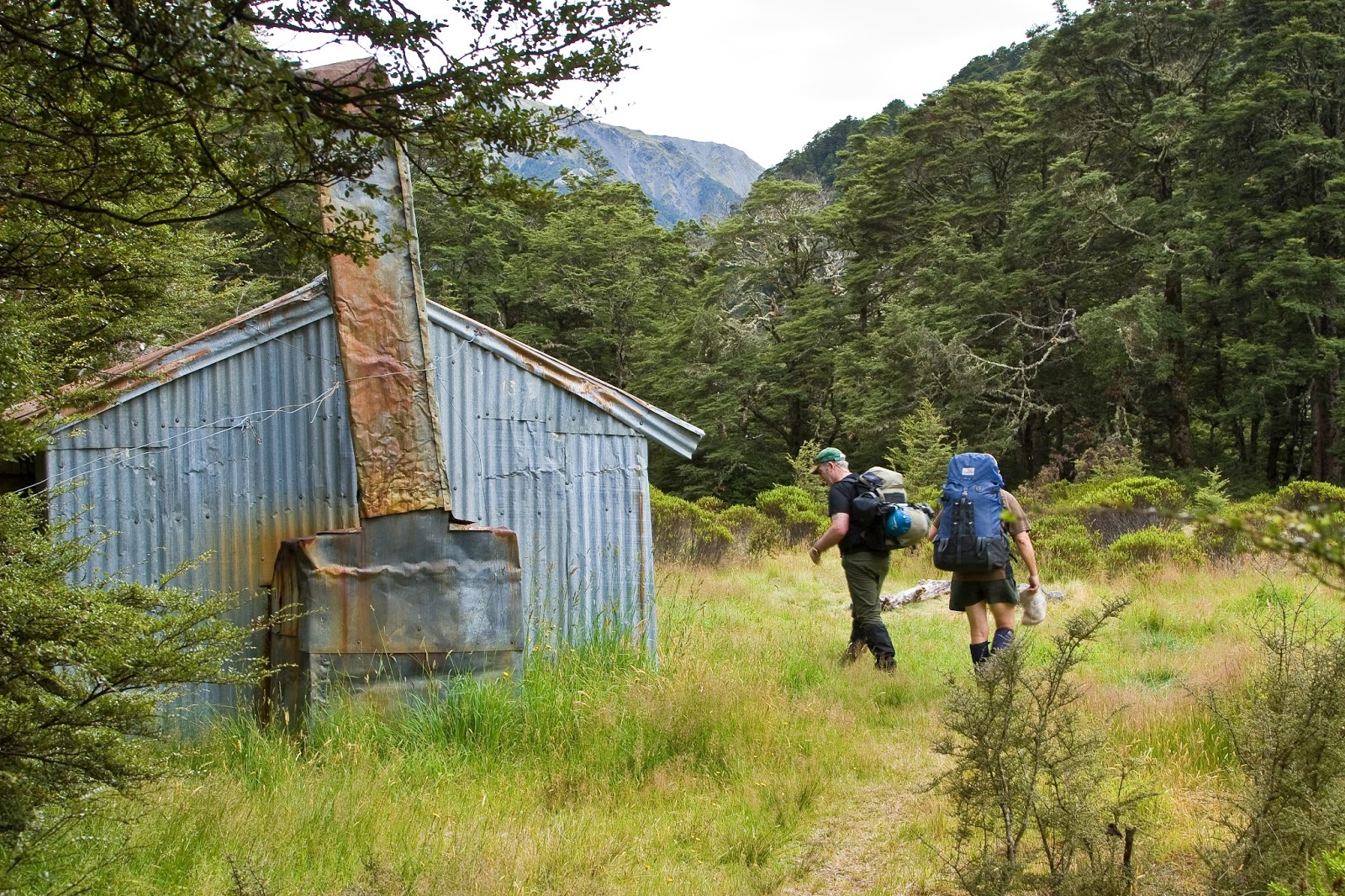
Cass Saddle Hut (3 bunks) was built in 1953. It has a corrugated iron exterior, around wood slabs that make up the inside walls, probably sourced from trees felled on site. Before Hamilton Hut was built in the 1980's this tramp was probably serviced by the Cass Saddle and West Harper Huts, making for a comfortable 3 day tramp with a night in each hut. On the day of our visit a party of 4 was in residence, it was 5.30pm and dinner smelt very good! It was hard to move on but with several hours still to go to reach Hamilton Hut we had to part ways.


Cass Saddle Hut

Looking down the Cass valley from Cass Saddle

View down Hamilton Creek from Cass Saddle, with the flats in front of Hamilton Hut just visible


A short trail through the bush behind the hut brought us out onto gentle tussock slopes that led up to Cass Saddle. The route is poled and works its way on an easy gradient up to the saddle, which stands at 1326m. The area is prone to avalanche in winter but would be an attractive place to visit with snow on the surrounding peaks. After a quick pause to take in the views it was time to move on.

The route makes a short sidle round from the saddle to the top of a bush spur, then makes the plunge back down to Hamilton Creek and the valley floor. The descent is very steep, especially at the top of the spur, but is well marked and tracked. The many hours of gradually gaining height were erased in quick time, and after around 45 minutes we had given back the hard earned height and were back on the flats following the river downstream toward Hamilton Hut, our shelter for the night. The track along Hamilton Creek is road-like, but slow progress was made, as it had been all day, due to one of our party discovering his lack of fitness early in the tramp. Still, we were moving towards the hut and make it we did, arriving at around 9pm after 8 and a half hours on the go.

Hamilton Hut (20 bunks) was built by the New Zealand Forest Service in 1983, part of their expanding programme of building bigger huts after the successes of their 4 and 6 bunk designs. It boasts 2 solid tables, stainless steel benchtops, running water, and a logburner for heating (with a ready supply of firewood in the shed behind the hut). The hut sits at 800m, perched on a grassy terrace above Hamilton Creek, just above its confluence with the Harper River, and offers good views of the Grey and Black Ranges.

Despite the luxuries on offer inside the hut, it was such a great night that 2 of us decided to sleep on the verandah under the stars - disturbed only by the resident possum scuffling on the roof, and by the sandflies, which woke before us and were hungry for breakfast!


Hamilton Hut sits perched on its terrace

Hamilton Hut

Early morning sun on the Grey Range, seen from the flats in front of Hamilton Hut


A glorious morning dawned, with the promise of warm weather for the day. With a nor'west wind forecast to pick up in the afternoon, and possibly bring a little rain with it, we were away early, endeavouring to make good time and beat the weather. Again...good intentions.

Day 2 started with an easy stroll along Hamilton Creek towards its confluence with the Harper River. A short distance along we crossed Hamilton on what looked to be a fairly new footbridge. Our map showed a walkwire here but the bridge is much more solid and less airy than a walkwire. The track took us along the true left of the Harper briefly, before crossing on a swingbridge to the true right where we would stay for some time.

Just as it was going up the Cass the previous day, travel was on superbly formed tracks, with the route making a few short, sharp climbs over bush spurs. After 2 hours comfortable walking we reached West Harper Hut, a good example of hut building in days of old.

West Harper Hut (5 bunks) was built in 1957 using beech saplings for the framing and to construct the bunks. The bunks themselves have sacking rather than the usual solid bench. There is an open fireplace and the hut even comes complete with a dirt floor. Corrugated iron provides the outer shell - simple hut construction from back in the days when building codes didn't enter the minds of those who endeavoured to create a shelter in the wilderness.

Our stay at West Harper was short lived - the sandfly population was healthy here too and with a few spots of rain falling it was time to get moving.

On we went up the Harper, our travel mixed now between bush tracks and short stints in the riverbed itself. Cairns were over-abundantly supplied - at one point there were 3 sitting side by side at a place were there was no possible risk of taking the wrong route. We crossed over to the true left before reaching probably the most critical route-finding point of the trip - the Harper-Long Creek confluence. It is easy to see how parties could mistakenly head up Long Creek, it is by far the more major tributary and makes the Harper look like a mere side stream, especially with the water flow as low as it was. Looking up the Harper there is a large orange marker triangle on a tree about 50m up the river - if you're looking you can't miss it.

Having correctly chosen our route, travel remained much the same, albeit a little rougher now. The boulders in the riverbed were bigger and the bush travel was often over or around slips, making for steeper sections than would perhaps normally be encountered. Our travel really slowed now, due to physical limitations within the party rather than any great difficulty with the terrain itself.

And so it was that we found ourselves still short of Lagoon Saddle Shelter (A Frame), our intended lunch stop, at 3pm. It was decided to sit by the track for a rest, some food, and a chance to regroup. It turned out we were only about 20 minutes from the A frame shelter below Lagoon Saddle so we just stopped to photograph it before continuing on, mindful of the time now.  The Lagoon Saddle A Frame Hut (as it's marked on maps) stands at 1140m on the edge of a nice little bush clearing just below the bushline. It was built in 1983 and is a much tidier place to stay than the older Lagoon Saddle Hut directly across the stream. Both are classed as 2 bunk bivvies.

From the shelter the route climbed steadily up towards the bushline and after a short while we emerged onto open tussock tops above Lagoon Saddle itself. Boardwalks led up to the crest of the ridge, where the best views of the tramp were to be found. The forecast cloud and wind had not yet arrived, allowing grand views to the peaks of the Waimakariri headwaters and western Arthurs Pass National Park. As we were taking it all in, an all too familiar sound was heard - the beeping and buzzing of cellphones as we picked up reception out on the tops...it truly is hard to escape it all these days!

It was now approaching 5pm so we set off across the tussock slopes beneath Mt Bruce. The route sidles directly across the face, descending ever so slowly as we made our way in and out of small gullies and through the thigh high tussocks. It was hot work, tramping across the exposed, north-facing slope with the late afternoon sun beating down, and we were relieved to reach the bushline again after about 50 minutes. All that was left was the descent through the bush and out to our waiting car at Cora Lynn.

It was a slow descent on weary legs but we eventually emerged from the bush at Bealey Hut (6 bunks) at 6:45pm, pausing briefly to exchange pleasantries with those who were staying the night, before plodding down the road to the carpark. Packs were dropped, boots quickly removed, and the feet saw their first fresh air since 8:30 that morning. Despite the long days and slow travel at times, it was a trip enjoyed by all, and comes highly recommended.


Crossing Hamilton Creek the easy way

Swingbridge across the Harper River

The Grey Range provides a scenic backdrop 

Pleasant travel up the very attractive Harper River

Side stream on our way up the Harper

Arriving at West Harper Hut

Inside the very rustic West Harper Hut

West Harper Hut

Lagoon Saddle Shelter

Out of the bush, above Lagoon Saddle

Looking back down the Harper from the tops above Lagoon Saddle

Checking cellphones on the slopes beneath Mt Bruce

View into the Waimakariri headwaters

Sidling across the face of Mt Bruce - impressive rockfall

Great views down the Waimakariri, Mt Binser in background on the right


Crown Copyright - Land Information NZ


Access: Track ends are both off SH73 from Christchurch to Arthurs Pass, just south of the Cass road bridge and at Cora Lynn, around 15km apart.

Time: Cass carpark to Cass Saddle Hut 4hrs, Cass Saddle Hut to Cass Saddle 45mins, Cass Saddle to Hamilton Hut 2hrs, Hamilton Hut to West Harper Hut 2hrs, West Harper Hut to Lagoon Saddle A Frame 3hrs, Lagoon Saddle to Cora Lynn 2hrs 30mins (note: these are usual times, not those described in our trip!)

Maps: BV21 Cass, BW 20 Lake Coleridge, BV20 Otira

Huts: Cass Saddle (3 bunks), Hamilton (20 bunks), West Harper (5 bunks), Lagoon Saddle A Frame (2 bunks), Lagoon Saddle (2 bunks), Bealey (6 bunks)