I had been eyeing up Mt Bruce for a while, as it makes for an excellent day trip and is not too far from home. In addition, my Arthur's Pass mountaineering guidebook describes the view from the summit as 'legendary', so with an endorsement like that I just had to check it out!
The forecast for the day was for a scorching hot afternoon, so I made an early start, leaving home at 4am, which, all going to plan, would see me reaching the summit around 8.30-9am, still in the nice coolness of the morning.
It was still dark as I left the carpark at Cora Lynn so I set off by torchlight. About 2 minutes along the trail lies Bealey Hut. Built in 1960, it's still reasonably tidy despite its' proximity to the road end, which often makes huts prone to vandalism. It boasts 6 bunks, and offers an option for those who may be looking to get an early start on the Cass-Lagoon tramp, or even an accessible night in the bush for those not so inclined to walk for hours to reach a backcountry hut.
After planting a Bible and leaving my intentions in the hutbook, I started on the climb up through the bush towards Lagoon Saddle. This section of track is part of the popular Cass-Lagoon Saddle tramp, a superb 2 day tramp through the area (see report
here), and also part of Te Araroa Trail, the nation-long walk through New Zealand. As such, it's a well maintained track that climbs moderately steeply through the standard Canterbury beech forest until at around the 950m contour it cuts across through a section of pine plantation. This made for a pleasant change to the beech, as I found myself walking on a nice carpet of pine needles - a far cry from the twisted roots that the beech trees often present underfoot.
The track made for fast travel, and in the dark I didn't really notice the altitude gain so much, so after an hour I found myself at the bushline just as the sun was casting its' first golden rays onto the mountains around. These were the first views of the tramp, and gave a taste of what might be to come as I got higher up the mountain. The photos probably don't so the scene justice...as with so many things it's much better to be there and experience it yourself.
My original plan was to head straight up the tussock slopes from the edge of the bush, then follow the east ridge to the summit. As I gazed up at the route I started to have some doubts, as there appeared to be some deeply incised gullies further up the mountain. From my position, I couldn't tell if I would be able to get across them higher up so made the decision to continue along the track towards Lagoon Saddle and approach the summit from the easier angled slopes on the northwest aspect of the mountain.
A quick ramble along the track, in and out of a series of small gullies that on our previous trip had seemed never ending at the end of a long day, soon had me where I wanted to be and I suddenly realised that every step was now taking me further away from my goal - it was time to leave the track and enter the tussocks.
My chosen exit point was probably, in hindsight, not the best choice, and I made a short, steep climb over a bump in the slope before reaching a nice flatter section to pause and survey the route ahead. The tussocks on this short climb made for tiring work, especially on the legs, as at times I was pushing through waist high grasses, but this was short lived and higher up the mountain they were much more stunted and easily travelled.
I took a moment on the flat section to plan my route. The summit was guarded by much steeper slopes, and some small bluffs and rock outcrops, and in places the grass slopes were replaced by steep, rocky sections. I figured it would be easier to skirt up along the edge of the rock slopes, and avoid having to traverse across them, so scouted a route that angled up under the largest rock outcrop then straight up on a mix of grass and rock to gain the short summit ridge. This proved successful and although I had now slowed a little, thanks in equal parts to the earlier draining section of long tussocks and to the fact I hadn't had breakfast, I soon found myself stepping out along the summit ridge with the large summit cairn in sight only metres away. A short wander along the ridge and I was there, on top of Mt Bruce.
The views as I reached the summit were stunning, with the peaks of the upper Harper catchment suddenly appearing, complementing those already on show across towards Arthur's Pass and into the Waimakariri headwaters, where prominent peaks such as Mts Harper and Speight looked stunning.
I spent around 45 minutes on the summit, soaking it all in while I had some breakfast, took photos, and looked for routes to do on future trips. The terrain on the other side of Lagoon Saddle looks inviting and may well require a visit in the future!
I had several options from the summit. The obvious one was to retrace my steps - an easy option but probably the least interesting. Secondly, I could take the east ridge (my original planned route) and look for a way back down to the bush edge and track back to my car, hoping that from above I could pick out a decent route down. This would still have meant heading back down the same bush track and as I'm always keen to tread new ground, and had plenty of time, I went with option 3: a descent to the saddle south of Mt Bruce then from there to follow Broad Stream out to the road, coming out about 2km from my car. I had read and seen a recent report that there is a track down through the bush in Broad Stream, which would offer reasonable travel until the stream bed widened out lower down.
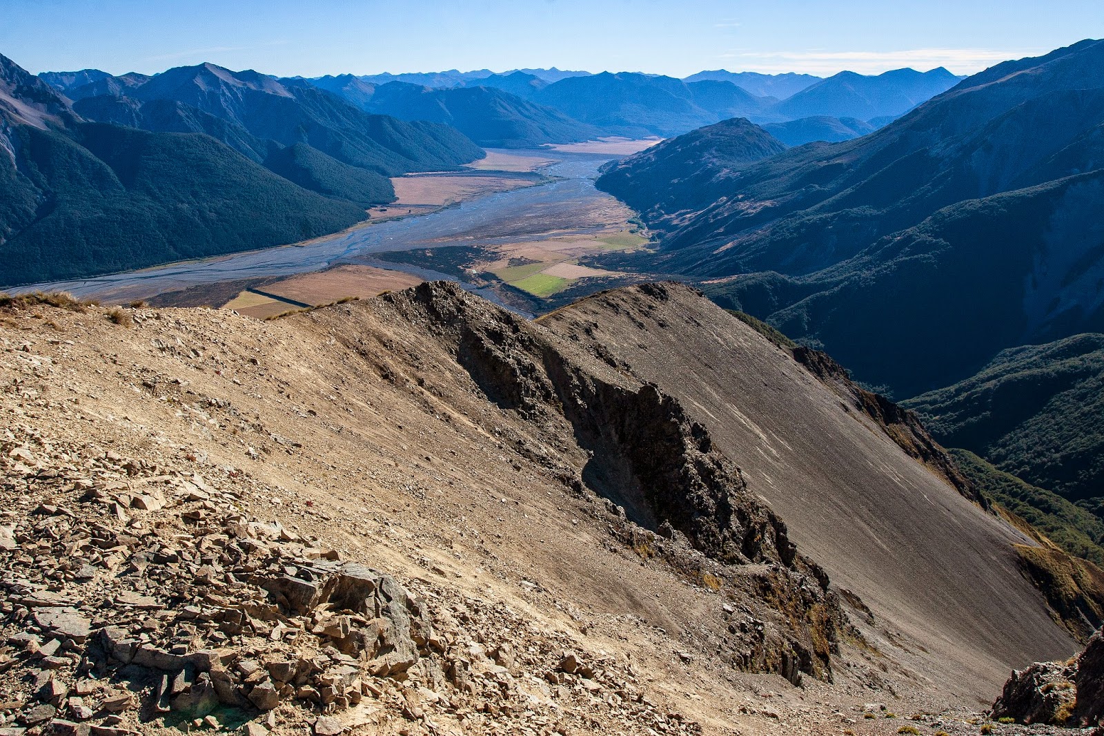
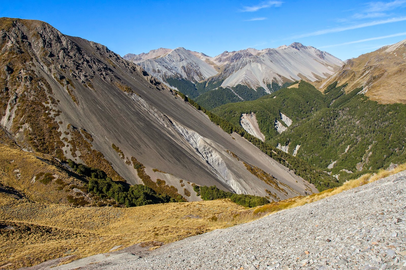
The descent to the saddle, which is known informally as Harper Saddle (at BV20 873316 - not marked as such on the current Topo50 map, but signs in Broad Stream call it by name), looked good, with plummeting scree slopes offering fast travel down to the tussock covered saddle. It was quite steep at the top, requiring a bit of care, then the angle of the slope eased slightly. The quality of the scree however was mixed, with sections of lovely soft stuff lasting just long enough for me to relax and enjoy it, before I would then hit a patch of horrible hard ground with a bare covering of loose rock. After a couple of near slips on these patches I decided to just take it slow and steady, and made it down to the saddle, which sits at around 1360m, unscathed.
From here it was back into the tussocks, stepping in and out of unseen potholes and over uneven ground - the usual hazards of travel in such terrain, and set off down the true right of the stream draining the saddle. I quickly tired of stepping into holes, so made my across onto a scree slope and sidled across that until I reached the bush.
I wasn't sure if the track entrance was marked or not, and my route across the scree saw me entering the bush higher up than I should have been. As I entered, following what was at first glance a track of sorts, it soon became apparent that I'd missed the mark as the "track" quickly petered out and I found myself bush-bashing. Knowing I had quite a way to go down to the forks in Broad Stream I decided to head left towards the stream, basing this decision on the fact that the track should be between me and the stream and I would intersect it somewhere along the way. Sensible logic...and it proved correct as after 5 minutes of solid bush-bashing I found the track. Then I saw the totally unexpected sight of a DOC orange triangle track marker - I'd known of the track's existence but didn't realise it was an old DOC track. Buoyed by this, and the fact that now that I was on the track things would be straightforward from here on out, I picked up the pace.
The track followed down a small spur between 2 small stream branches, then at the first small forks it crossed to the true left for most of the way down to the main fork in Broad Stream (at BV20 895327), with the odd crossing here and there. It's easy going, the track is well marked but is slightly overgrown as it's no longer maintained. Broad Stream is quite narrow, and would be slow going if you were to try and make your way down the stream itself - find the track and follow it!!
Below the forks the track continued in much the same vein, crossing where bluffs force it to. The further down stream I got, the better the track became. As the stream began to open out cairns started to appear and the track gave the appearance of one that gets quite a bit of use. Perhaps the owner of Cora Lynn Station has done some work in the lower reaches of the stream, offering easy walking options for visitors to their Wilderness Lodge, as in places the sides of the track are lined with stones, giving the track a path-like feel and look to it.
By now it was hot, and I was very tempted to try and cut across the back of Cora Lynn directly to the carpark. However, those sort of antics don't endear trampers to local land owners, so I kept my line along the bank of the stream, following the fenceline all the way out to the road. It had taken around 3hrs from Mt Bruce down to the highway, and all that was left was to leg it back along the road and up the drive to the car. I was hopeful of hitching a lift but all I got was a friendly hello from a passing cyclist. I got back to the car around 12.45pm, making it a 7hr round trip including my time on the summit, and I was pleased I'd made the effort to get an early start - it was going to be a blazing hot afternoon.
A fantastic day out in a beautiful part of the country, and one that has inspired further exploration in the area.
 |
| Reaching the bushline as the first rays of sun strike the mountains |
 |
| First light on Mt Rolleston (2275m, back right of image) and surrounding peaks |
 |
| Looking up the Bealey River where it joins the Waimakariri (foreground) |
 |
| Early morning sun hits Dome (1945m) |
 |
| View down the Waimakariri River, Dome at left |
 |
| View from bushline - Jellicoe Ridge (far left), Mt Rolleston (rear, left of centre), Mt O'Malley (right of centre), looking towards Arthur's Pass |
 |
| Looking up towards Mt Bruce, from the track across its' lower slopes |
 |
| In the tussocks, early in the climb to Mt Bruce |
 |
| Views become more expansive |
 |
| Mt Bruce (1630m), guarded by steep upper slopes |
 |
| My route up through the bluffs and rock outcrops, surveyed from the flatter section I stopped at |
 |
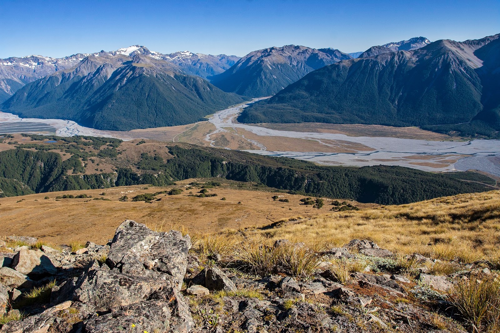
| Waimakariri headwaters, from the upper slopes of Mt Bruce |
 |
| View down the Waimakariri, from the upper slopes of Mt Bruce |
 |
| Lagoon Saddle |
 |
| False summit cairn on Mt Bruce, the true summit is not far away though, and the many peaks of the Waimakariri headwaters and western Arthur's Pass National Park |
 |
| Looking up the Bealey River. Mt Rolleston (with Crow Glacier visible just below its' summit, left), Mt O'Malley (centre), and Mt Oates (right rear) |
 |
| Summit cairn on Mt Bruce |
 |
| East Ridge of Mt Bruce, with the Waimakariri River beyond |
 |
| Saddle 1360m (Harper Saddle), and Pt 1672m on the Black Range |
 |
| Upper Harper River and Long Creek peaks - Packard Peak (2066m) far right |
 |
| Dome (1945m), taken from the summit of Mt Bruce, with Mt Oates (2041m) rear, left of centre |
 |
| On the summit of Mt Bruce, backed by the Waimakariri |
 |
| L to R: Mts Greenlaw (2315m), Speight (2116m), and Harper (2222m) - (I think!!, not completely sure which is which through the middle) |
 |
| Mt Rolleston (2275m) |
 |
| Dome (1945m), and Mt Oates (2041m) at rear |
 |
| Area around Arthur's Pass village (located in the valley heading up to the left, centre image) |
 |
| Waimakariri River, with Bealey Spur & tarns in front, Turkey Flat (the obvious fan in the river bed), and the Crow Valley upper right |
 |
| Packard Peak at the head of Long Creek, Mid Hill rising out of frame on the right - looks like good terrain to explore |
 |
| Looking down into Broad Stream as I descend from Mt Bruce to the saddle |
 |
| Huge scree slopes typify the area, Packard Peak at rear |
 |
| Looking down Broad Stream from the saddle at 1360m |
 |
| Looking back up at Mt Bruce as I start to descend Broad Stream, saddle at left |
 |
| The track down Broad Stream |
 |
| The track (slightly overgrown) down Broad Stream |
 |
| Bridge across Broad Stream - wasn't sure if it would hold me (it did!) |
 |
| Bridge across Broad Stream - wasn't sure if it would hold me (it did!) |
 |
| Do I...or don't I??? |
 |
| Mt Bruce (1630m), seen from the highway near Broad Stream. Note the pine plantation |
 |
Crown Copyright - Land Information NZ
Access: Follow SH73 towards Arthur's Pass. Turn left at the Cora Lynn Wilderness Lodge sign and follow signs to the car park.
Time: Car park to bushline 1hr, car park to summit 3hr 15mins, summit to road via Broad Stream 3hrs
Map: BV20 Otira
Hut: Bealey Hut (6 bunks)
|


