Leaving the carpark, a vehicle track heads across farmland before entering the bush. Note that while access along this vehicle track is permitted, the surrounding land is private so keep to the track! Just before entering the bush I passed the Peyton Scout Den, nicely sited in an open, sunny clearing.
The track through the bush is well maintained and very easy going, climbing initially at a gentle gradient before steepening to climb in several 'steps' towards the summit, with short flatter sections giving a break from the steady ascent.
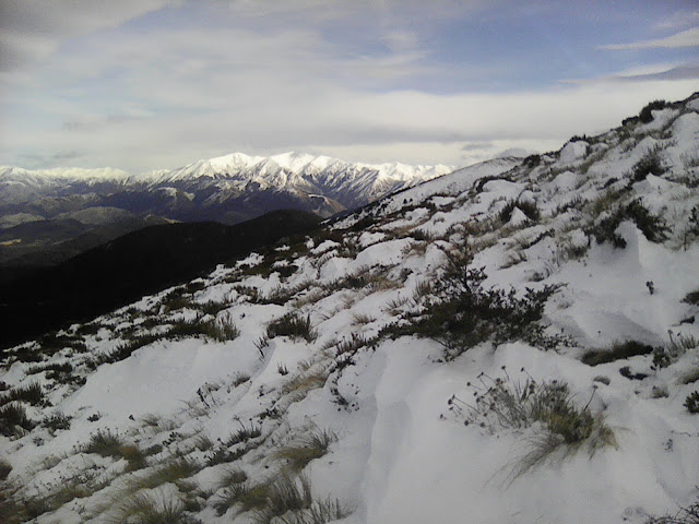
Above the bushline, snow underfoot made for good fun although I was forced to walk just off the main track as the compacted snow on the track had frozen to ice. This was a minor inconvenience and I made good progress in the softer, untouched snow that lay at the sides of the track. Fortunately it was generally only mid-shin to knee deep, so was pretty easy going.
A bitterly cold nor'west wind was sweeping across the exposed slopes above the bushline, and it wasn't long before I was reaching for a fleece jacket and beanie - unusual for me as I'm typically a very warm tramper and rarely wear more than one layer.
Extra layers in place, I leaned into the wind and started the uphill plod up the final slopes to the summit, its visibility from below spurring me onwards and upwards. The snow deepened but didn't slow me too much, and before long I was taking the final few steps to the broad summit.
Surprisingly, I had company there. One hardy tramper was already hunkered down in the shelter of the rock wall that adorns the summit - the wall being testament to the winds that frequently batter these exposed tops.
Despite the rock wall, it was icy cold on the summit so my stay was brief, long enough for a quick bite but even then I was beginning to feel cold so I decided lunch could wait for the cosier confines of the car and began my descent.
I had planned to head east along the tops, passing over Oxford Hill to Ashley Saddle and then down an open spur that would take me to the vicinity of Peyton Lodge. However with the weather conditions as they were, a more hasty, less adventurous descent was the prudent option on this day, and so I retraced my steps directly to the shelter of the bush and the car.
(Again, the photos are taken on my cheap phone so are a bit poor)
 |
| Looking out over the Canterbury plains, from about halfway up Mt Oxford |
 |
| Still a way to go |
 |
| Nice light hitting the Torlesse Range, not really well captured on the phone! |
 |
| Deepening snow as I gained height |
 |
| Mt Oxford summit (1364m) - it looks calm, but photos don't always tell the story |
 |
| Looking across to Oxford Hill and my originally intended descent route via Ashley Saddle. The tussocks show the wind quite well. |
 |
| View across the plains to Mt Hutt |
 |
| Last steep drop on the descent, and nearly out of the wind |
 | |||
| Crown Copyright - Land Information NZ |
Access: From Oxford township, turn right onto Woodside Rd at the western end of the town and follow until Mountain Rd. The carpark is at the end of Mountain Rd. As mentioned in the text, the route starts through private farmland, stick to the marked track.
Time: Carpark to summit 2hr 20mins, return 1hr 45mins
Map: BW22 Oxford
Hut: None
